
Home | Personal | Outdoors | Travels | Blog | Work | Weather | Site Map
|
Home | Personal | Outdoors | Travels | Blog | Work | Weather | Site Map
|
|
|
Home | Personal | Outdoors | Travels | Blog | Work | Weather | Site Map
|
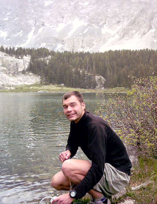
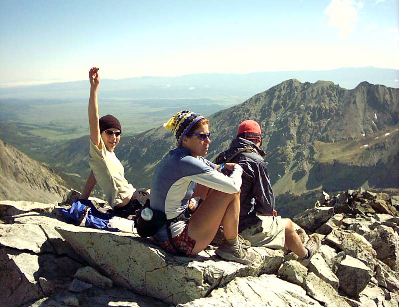
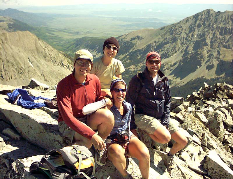
Fellow Adventurers: Eric Sigler, Sara Ridgway, Ricky
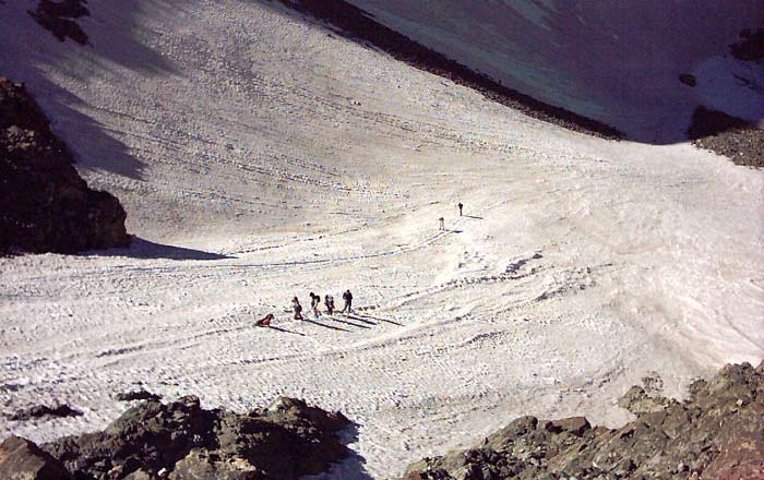
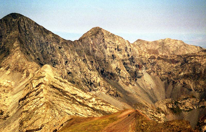
In this view, from about 12,000 feet, Ellingwood is basking in the morning sunshine at center left.
Located in south central Colorado, just east of the San Luis Valley, the Blanca Group (Blanca Peak, Ellingwood Point, Little Bear Peak, and Mount Lindsey) sweeps up from the high desert valley to the west. Blanca Peak is Colorado's 4th tallest mountain. There are no foothills, so the rise is dramatic, giving some these peaks the highest vertical relief of any of Colorado's 14'ers besides Pikes Peak. The only nontechnical approach to Blanca, Ellingwood, and Little Bear is via the famously rough Como Lake Road (which is passable only for those with serious 4WD vehicles and lots of patience and nerve). Many people backpack up to Lake Como and then summit from there. For the serious mountaineer, technical routes also approach Blanca from the North Huerfano valley to the east (this is the standard approach to Mount Lindsey -- click here for my trip report for Mount Lindsey).
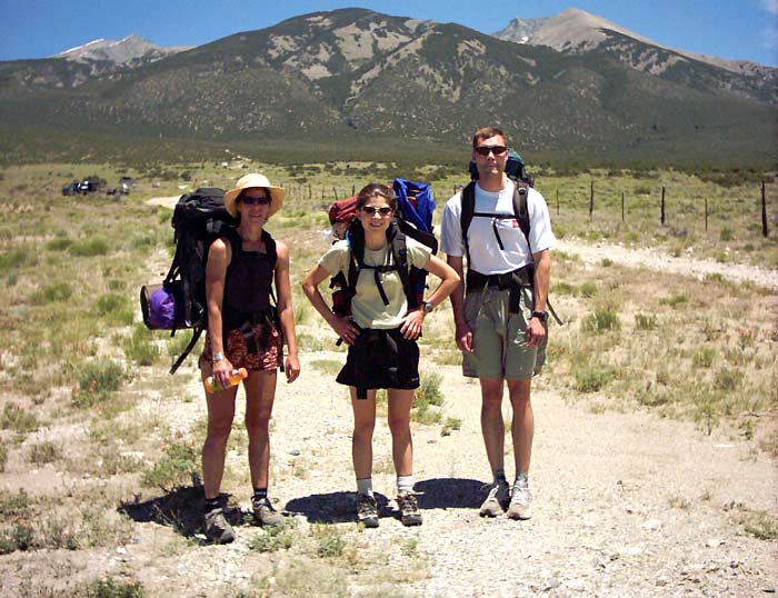
Blanca and Ellingwood are a very long ways from Fort Collins, where I live. On Friday, June 27, I drove down to Eric's house in Boulder and we continued on to Salida to stay with Sara, who was very gracious in opening her home to us. On Saturday we hung out in Salida for a while, taking in the ambiance of the Art Walk festival and the river, then finished packing and hopped in Sara's car at about 11 AM. We picked up one of her friends, Ricky, and drove to the Lake Como Trailhead which is on a lonely dirt road off of Colorado 160. Our excitement was building after driving through the barren San Luis valley for the last hour. We parked just as the road began to climb up the slopes of the Blanca Group. Starting elevation: 7700 feet, one of the lowest 14'er trailheads in Colorado!
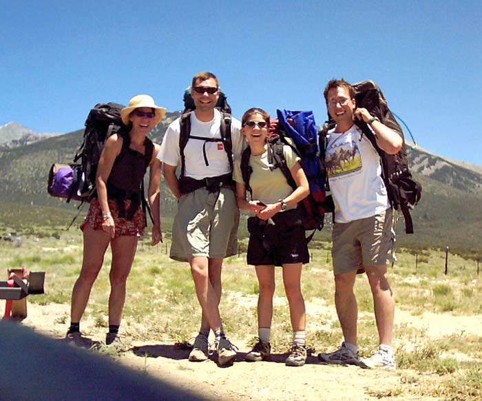
Note our happy smiles. This is going to be a grand adventure as well as a terrific workout. Also note our backpacks. We decided to 'take it easy' and do Blanca/Ellingwood in two days. So part of our approach included backpacking up 4000 vertical feet and 6 miles along the infamous Como Lake Road just to get within reach of the elusive summits. We started hiking at about 2 PM. The temperature was about 70 degrees with warm sunshine and gentle westerly breeze. We were soon very warm.
From this picture, the seemingly gentle slope of the antiplano is evident. It is deceiving -- in fact the road climbs nearly 1000 feet in a straight shot before the first switchback! After numerous switchbacks and another 1000 vertical feet, the road enters the Chokecherry Canyon to the left of the picture. Blanca and Ellingwood aren't even visible from this perspective. They are hiding back in the remote Lake Como basin.
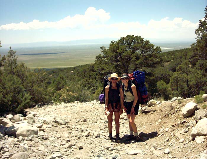
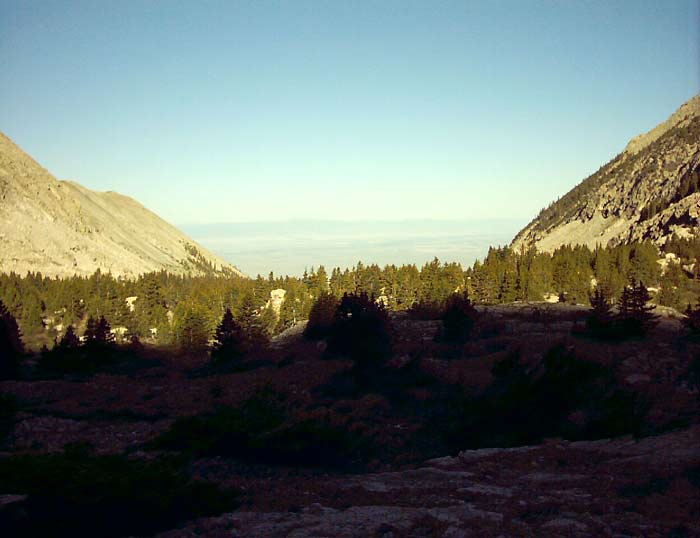
This is the view after climbing about 2 miles and 1500 vertical feet to perhaps the end of the second switchback. Sara and Ricky are still wearing smiles -- they are enjoying the intense workout! The thin strip of pavement just beyond the trees is Colorado 160, near the trailhead. For about the first 2000 vertical feet, the car was still visible, which was a bit disconcerting. As we continued to climb, the horizon lifted and the San Luis Valley became three dimensional. We could tell that we were getting higher. For the geometry lovers out there, we were leaving Flatland.
Soon after this point, we entered Chokecherry Canyon. For nearly the entire six miles, the road is about how it look in this picture -- loose dirt and rock -- definitely a test on the ankles. Hiking boots may come in useful. Once in the canyon, the hot desert winds subside to the sound of distant roaring water coming down from the Como Basin. There are several opportunities to obtain water, but we carried enough to get us up to the lake. The canyon seems a bit friendlier, and the shrub and pines give way to some aspen and other deciduous plants. For a short stretch, the road actually passes through a delightfully-shaded wood. After crossing a substantial creek, the road starts climbing steeply again on the north side of the canyon. We passed several abandoned mining cabins and some massive boulders in the road that seemed incredible to even think about driving over. There were not many vehicles on the road that day (most were parked in the lowest two miles), but we did see a few motorcyclists. Climbing ever higher, we finally reached the beautiful Lake Como at about 5 pm. We had climbed 4000 vertical feet and traveled 6 miles with our 30 pound packs in only 3 hrs! Needless to say, we were ready for some supper.
But first, we had to filter some water.

As Eric filtered the water, Sara and Ricky set up camp. They would enjoy the luxury of the 5-lb tent that they carried all this way. Eric and I decided to stick with the lighter bivy sack option.
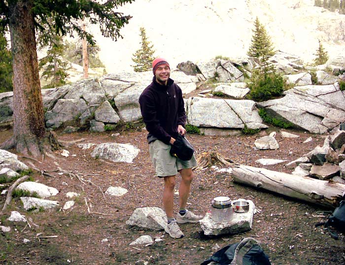
Soon supper was underway. We enjoyed a pasta creation with a cheese soup, bread, and some of Sara's delicious raspberry bars.
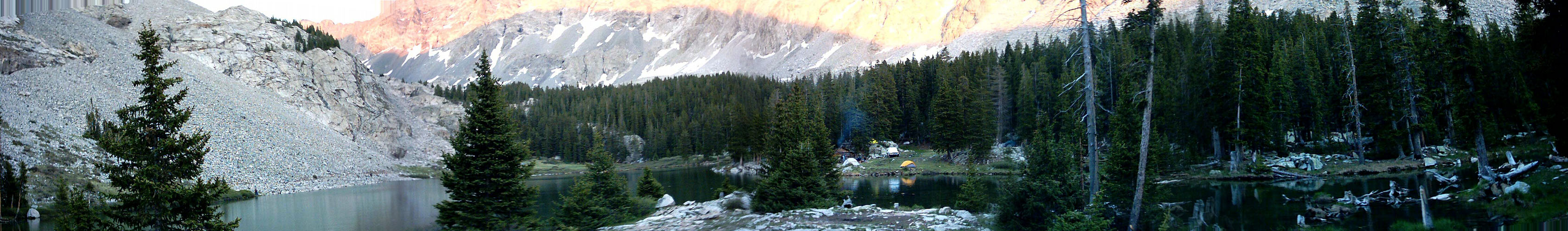
Here is the panorama of Como Lake at sunset. The setting sun made for a beautiful alpenglow on the bulwarks of Little Bear.
Click the panorama to see the full size [453 Kb].
Or if you have a high speed internet connection, you can view the panorama using this interactive panorama viewer [1.18 Mb].
If you have trouble viewing this file, you can also download this executable, save it to your desktop, then double-click on it to view the panorama. The executable file contains a viewer that should work regardless of your web browser.
After a walk around the lake, we hit the sack to allow our bodies a little time to recover for the hard day ahead. The temperature cooled from the evening's 50 deg into the lower 40's -- quite pleasant sleeping weather if you have a zero-deg bag! In the middle of the night, a strong wind blew for a time, but I barely woke enough to notice.
Since the sun rises very early in Colorado in the summertime, we woke up between 5:30 and 6:00 AM. The temperature was a mild 40 deg, considering that we were at 11,700 feet. After trying to reinforce our bodies with some oatmeal and fruit along with other varied snacks, we set off into the upper reaches of the Lake Como Basin. Despite our 4000 feet climb yesterday, we still had 2300 more feet to climb to get to Ellingwood's summit, the lower of the two 14'ers.
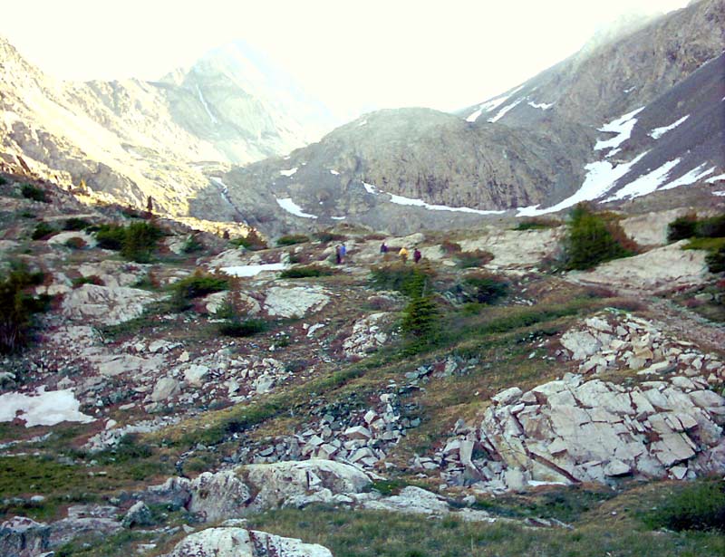
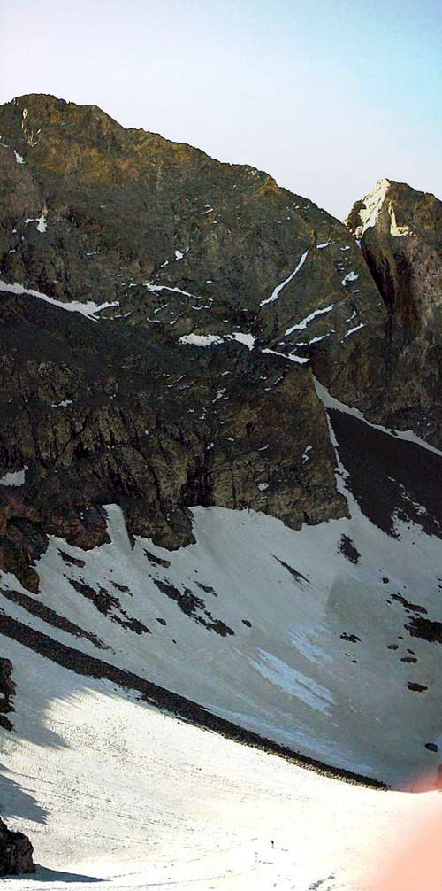
Ellingwood's pointy summit basks in the early morning sunshine, as seen from 12,000 feet.
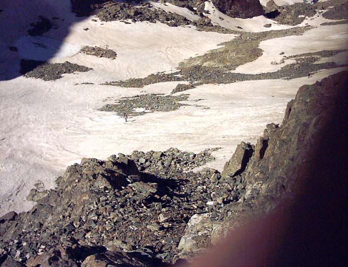
Turning around for a moment, this is the view we saw to the west overlooking Como Lake and down Chokecherry Canyon. The road petered out into a trail about a mile past Lake Como. Soon the trees melted away to beautiful alpine tundra. We passed several small lakes, crossed some streams, and ascended past a 300 foot tall cascade onto a bench. The basin grew wilder and soon we passed an ice-covered lake. We traversed around the north side on a snow-field and then reached the huge amphitheatre formed by Ellingwood, Blanca, and the headwall in between. Broken cliffs and steep snowfields blocked easy access to the saddle. We decided to shoot for Ellingwood first since it was closer and lower. About this time we saw several other groups of like-minded individuals, all seeking the 14'er experience. Most went for Blanca as we climbed towards Ellingwood.
The snow was surprisingly hard-packed, and crampons and ice axes would have been useful in some spots, but the run-out was so long and gentle for much of the snowfield that we weren't too worried about falling. Note the dog in the picture -- he seemed to be doing quite well with his '4WD'.
This 'upward' panorama gives you an idea of the sheer size of Blanca. Note the minuscule hikers near the bottom! We searched for an easy way up to Ellingwood. Eric decided to scale a trough that lead to the summit. Sara, Ricky, and I opted for a more circuitous, but less steep route that wound through a couple snowfields.
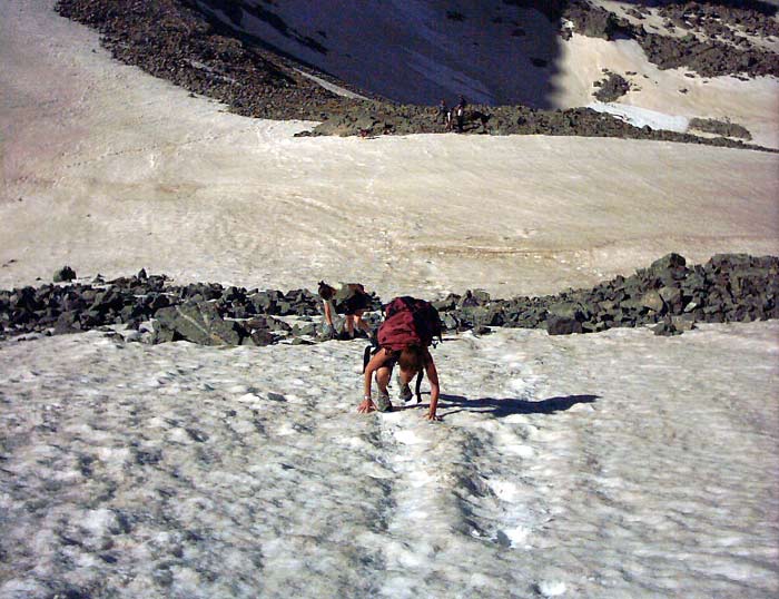
Leaving the main snowfield, I started climbing some steep but solid rock (class 3).
After crossing a few more steep snow fields, we gained access to the connecting ridge between Blanca and Ellingwood. From here it was just a few hundred more feet to the top. From atop one of Colorado's greatest mountain walls, the view down into the Huerfano Valley was breathtaking.
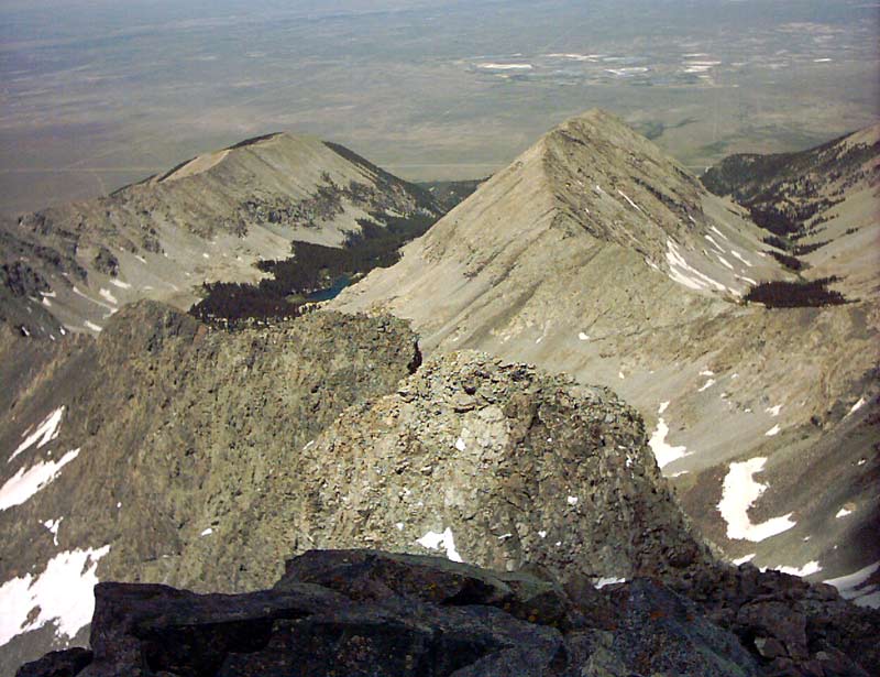
To get an idea of where we were, here is a picture taken from Mount Lindsey on a previous expedition looking towards Blanca and Ellingwood. Blanca is on the left and Ellingwood is the lesser peak in the middle. From this perspective, it is easy to see why Blanca is only approached from the west by the casual mountaineer. The eastern approach is only for the seasoned climber! Continuing up the connecting ridge, we finally reached the summit of Ellingwood, about two and half hours (and 2 miles) after leaving Lake Como.
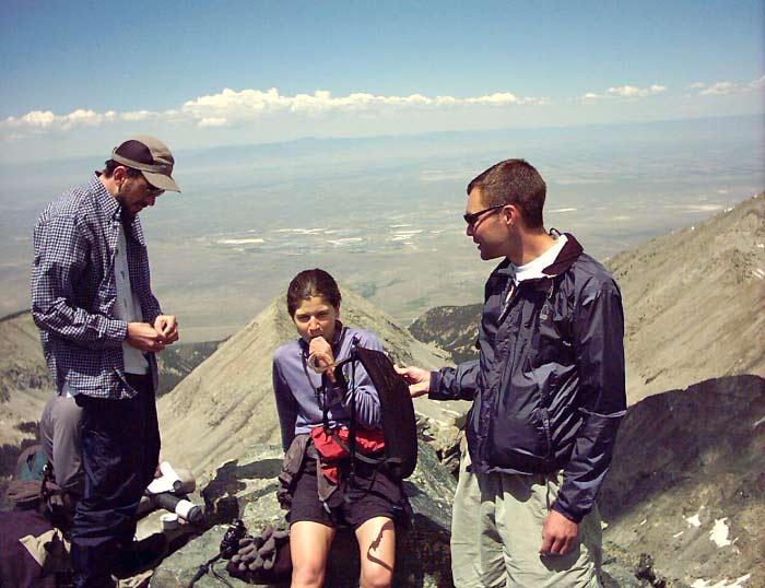
We spent about 15 minutes soaking in the awesome view from Ellingwood Point. This was my 19th Fourteener, Eric's 23rd, and Sara's 33rd peak. The sunshine was very warm and there was little if any breeze. We made sure to sign the trail register, apparently the first to summit this day. Only one other person was on the summit while we were there, although some others were on their way.
To get the full immersive experience, I've prepared a 360 degree panorama, viewable either as a picture or with a panorama viewer:

W N E S
Click on the panorama to see the full size [810 Kb].
Or you can view it interactively using this panorama viewer [2.48 Mb -- warning, this will take a while to load on a modem connection].
If you have trouble viewing this file, you can also download this executable, save it to your desktop, then double-click on it to view the panorama. The executable file contains a viewer that should work regardless of your web browser.
From left to right, the main features are:
1. San Luis Valley to the West, as well as several canyons
2. The Great Sand Dunes National Monument to the Northwest
3. The Crestone Group are in the far distance to the North
4. Mount Lindsey lies to the Southeast
5. Blanca Peak lies due South
6. and Little Bear, arguably Colorado's hardest 14'er lies to the Southwest at the edge of the panorama. Needless to say, we were not even thinking about crossing the astonishing connecting ridge to bag Little Bear -- that will have to wait for a separate expedition when we have much more rock climbing experience.
From here we spent some time contemplating Blanca's unbelievably steep north face. It was hard to imagine how we were going to get up it. In reality, it is not as bad as it looks, although it is definitely imposing. The rock up the ridgeline is surprisingly solid. The actual tricky part is near the low point of the saddle -- some class 3 scrambling is required to get across about 100 feet below the actual saddle. Then after a short scree climb, we just climbed up the ridge to Blanca's summit.
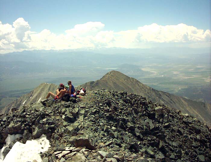
After about an hour and a half of some careful route-finding, we powered up Blanca's steep northeast ridgeline and summitted about about Noon. Several other groups were already up there.
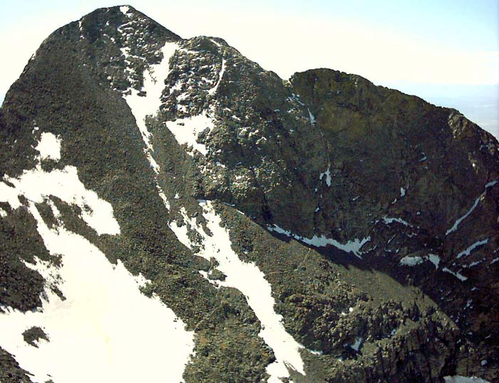
Blanca's imposing north face as viewed from Ellingwood Point, half a mile away and 300 feet lower.
Sara is hydrating atop Blanca.
This is the view of Little Bear from Blanca's summit. From this picture it is easy to see why it has the reputation is does.
This is the view from Blanca's summit looking south. The southern approach is actually not very difficult but there is no trailhead and the land is private property.
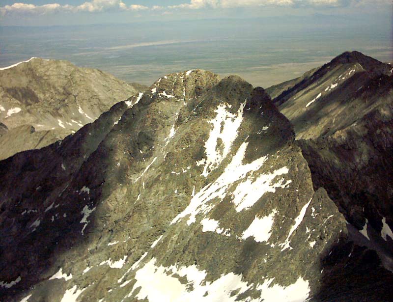
And this is the view of Ellingwood Point from Blanca's summit. More than 300 feet smaller, Ellingwood is still impressive. We ascended from the main snowfield in the center bottom up towards the ridge on the right and then along the ridgeline to the summit. The class 3 traverse across the saddle to Blanca is also partly visible. I had to take a major detour around the steep snow gully due to the large 50 foot notch in the ridgeline on the right hand side.
This last picture looks down the Lake Como Basin (can you see Lake Como?) through Chokecherry Canyon and down to the desert floor. Somewhere down there is the car! Only 8 miles and 6600 vertical feet!
The weather at the top was very mild with light winds. The temperature was about 46 degrees. Low clouds covered the Plains to the East due to a cold front which had moved through previously. While we were on the summit, an amazing event occurred. A huge parcel of air came up from the valley right past the summit forming an instant cloud which grew and billowed upward for thousands of feet -- all in the course of a few minutes. I took a couple video clips which may be viewed using Windows Media Player. If using a modem, the broadband version will take very long, so a reduced-quality dial-up version is available:
Clip 1: Broadband [2.10 Mb] or Dial-up [176 Kb]
Clip 2: Broadband [1.97 Mb] or Dial-up [180 Kb]
These files are in Windows Media Player format, so they should load automatically if you're on a Windows computer. There is no sound (in case you were expecting some).
By this point, I had used up all the memory in my tiny Aiptek camera, so I have not pictures to show of the descent. It was much faster going down than up, especially because I was able to slide down several hundred vertical feet on some snowfields, which was a blast. About an hour and 45 minutes later, I cruised back into Lake Como and started to pack up. After a snack, we headed down to the car.
I reached the bottom in an additional hour and 42 minutes, or at about 3:30 pm. For the last two to three miles and 2000 vertical feet, the car is visible from time to time, which is a bit discouraging. Not until the last mile do you start to feel that it is close. But if you pay attention, hot summer afternoons tend to breed a variety of dust devils out in the valley. These can be entertaining to watch as they take your mind off your aching feet.
Everyone was down by 4:30 pm, so by 5 we were on the road. About this time, some incredible storms built over the entire Sangre de Cristo range, and various circulations were kicking up dust across the San Luis Valley, making the drive home a little more interesting.
If we had done this as a day hike, it would have been a VERY long grade III hike (very few of the 14'ners have a standard approach which is grade III). Over the two days (roughly 24-h), we put in 7700 feet of vertical climb and between 17 to 18 miles! Some of us may have gotten ourselves into Class 4 rock below the saddle, but the actual route is only Class 3 in that one spot, and Class 2 elsewhere in the upper basin. All told, this was a fantastic workout and a great climb. Someday we will have to come back and climb Little Bear.
Home | About this Site | Disclaimer || Site Map | Subscribe to be notified when new content is posted to this site
|
Home | About this Site | Disclaimer || Site Map | Subscribe to be notified when new content is posted to this site
|