Home | Personal | Outdoors | Travels | Blog | Work | Weather | Site Map
|
Home | Personal | Outdoors | Travels | Blog | Work | Weather | Site Map
|
|
|
Home | Personal | Outdoors | Travels | Blog | Work | Weather | Site Map
|
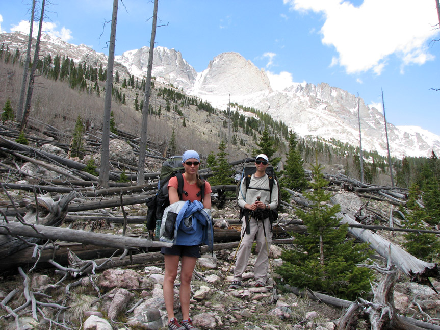
Crestone Peak: Summit Attempt #2 and Hike OutThis is the Part II of a two part trip report of a multiday backpack and climb of Crestone Peak. To see the first part, click here or go back to expedition summary. Second Summit Attempt, Saturday, May 26, 2007
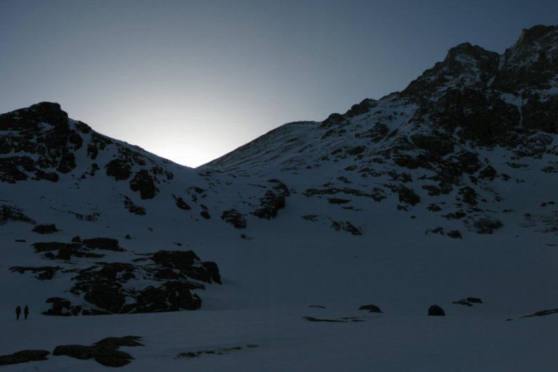
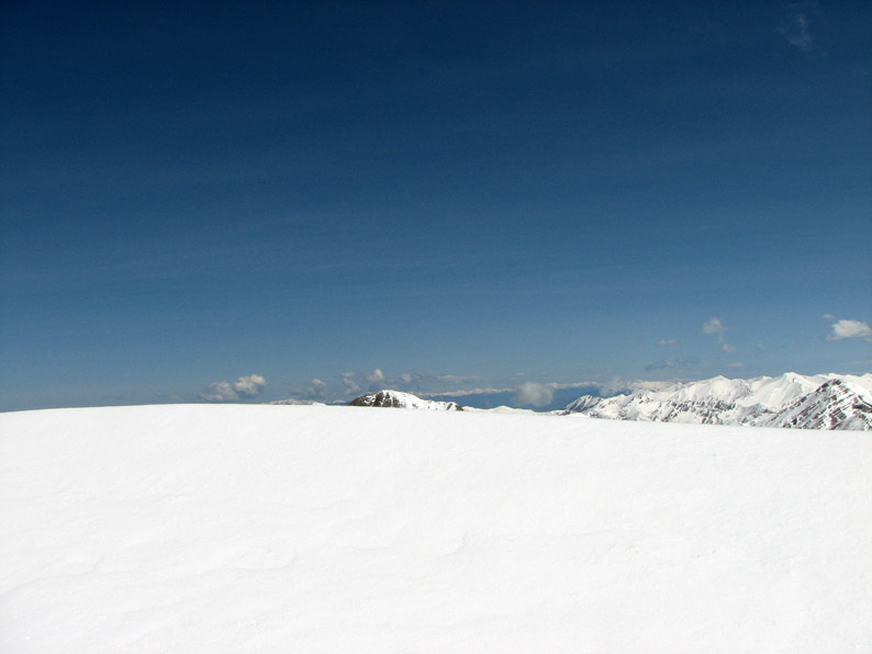
We were up well before dawn and headed up the trail at 6:00 AM, just as first light was breaking. By the time we reached the tree line, the sun was getting serious about making an appearance. Today the weather was clear with very little wind - perfect conditions for a summit attempt! After yesterday's failed attempt, we were eager to make the summit if at all possible.
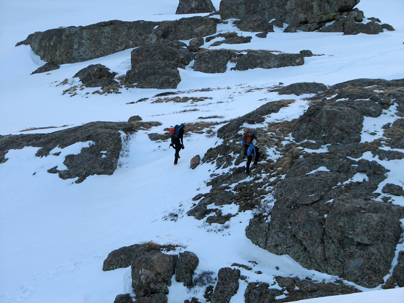
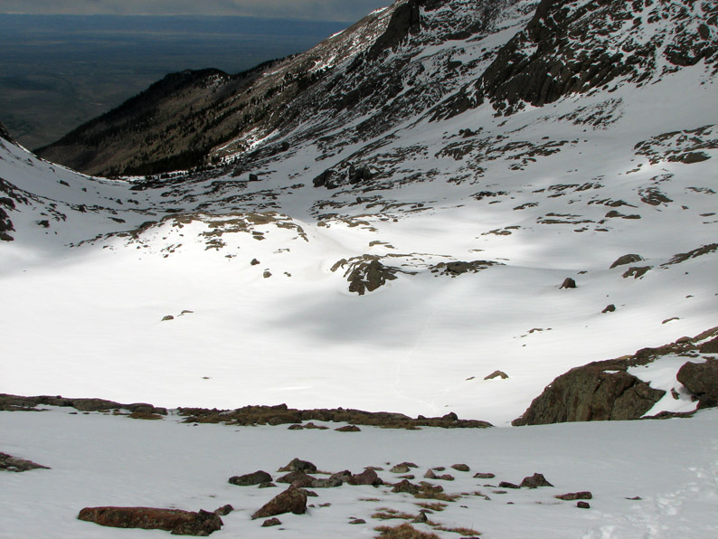
The first part of the climb was very familiar. With the clear conditions, we were able to see how we'd gotten off track the day before. It was a good thing we turned around yesterday - we might have ended up climbing the wrong peak! We reached the 12,400 foot bench at around 7:38 AM.
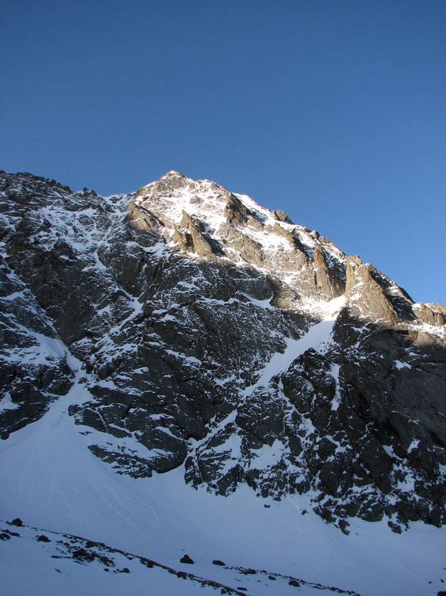
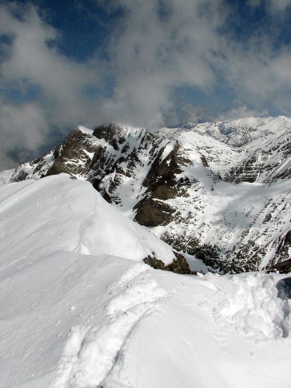
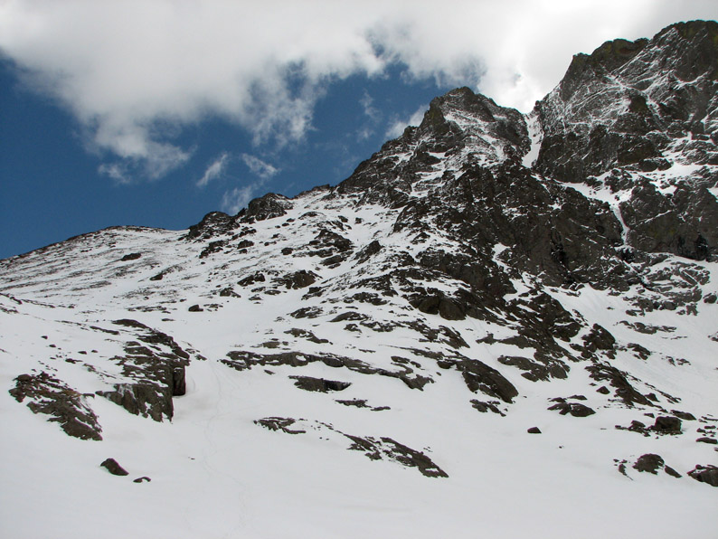
Soon the sun was hitting the summit with it's glorious rays. Our imposing challenge loomed before us!
The lower part of the mountain didn't look so bad - the guidebook suggested going to the left up to the Bear's Playground. We didn't see any reason why we shouldn't just go straight up, so we did, angling through the center cliff bands.
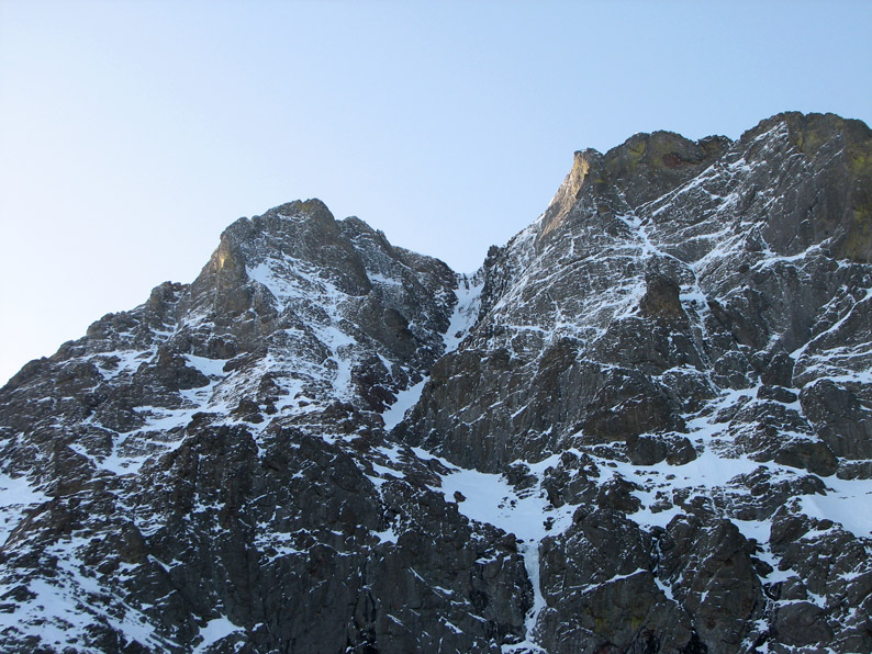
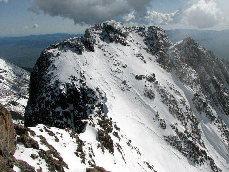
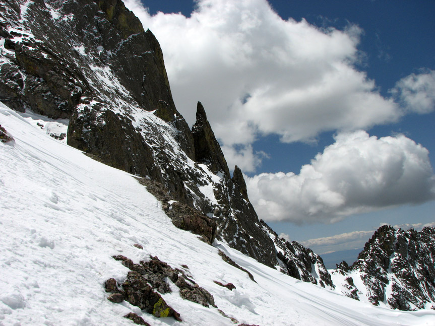
The alpine scenery was absolutely incredible - it felt like we were in the Alps or the Andes, not the Rockies.
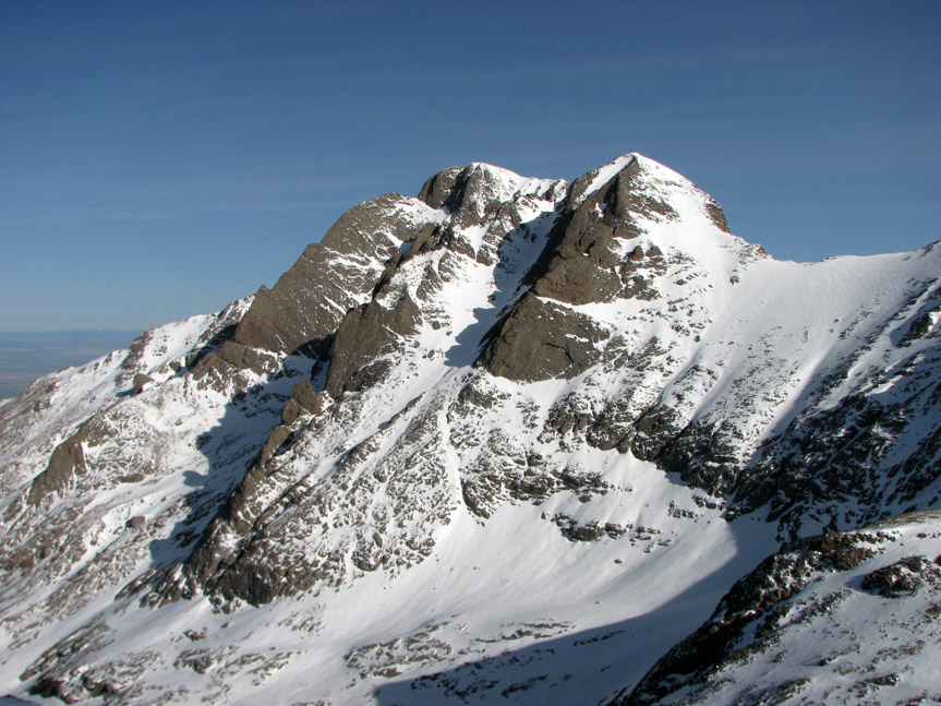
Challenger and Kit Carson loomed across the valley. As we climbed higher and higher, our perspective changed and these peaks seemed to get taller and steeper.
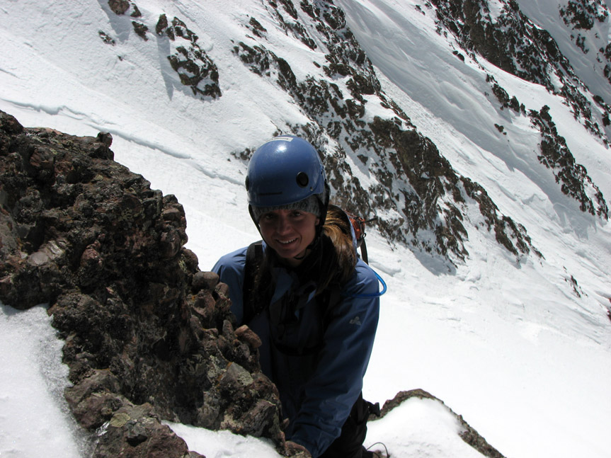
Meanwhile, on our side of the valley, things were getting steeper as well. The look on Ali's face says it all: "What have we gotten ourselves into?"
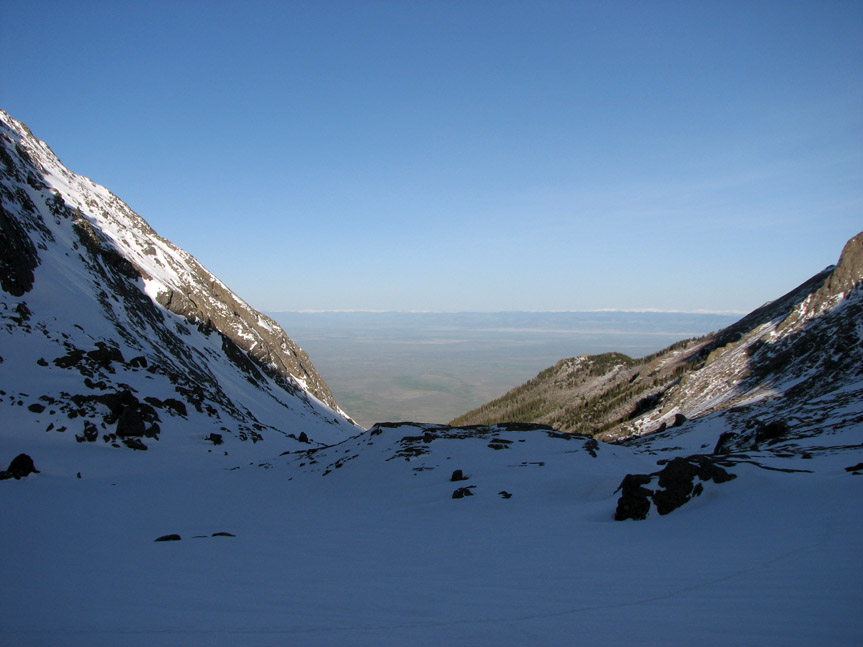
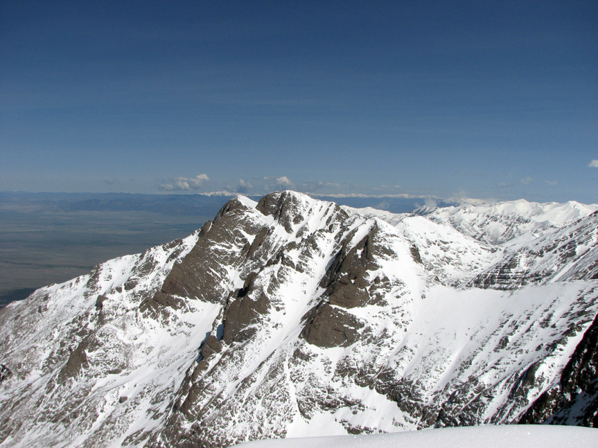
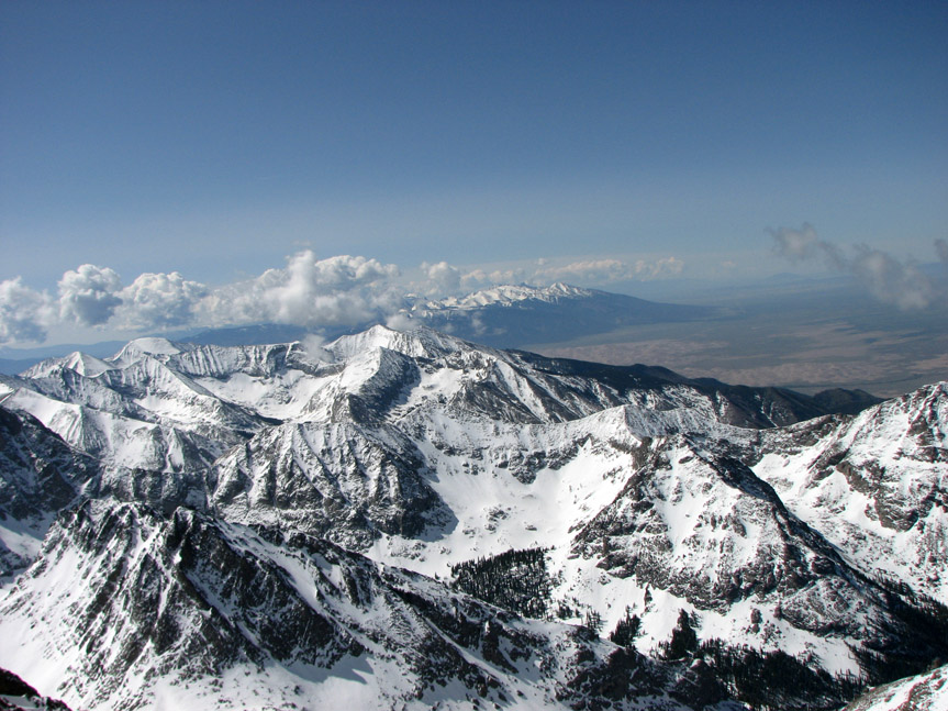
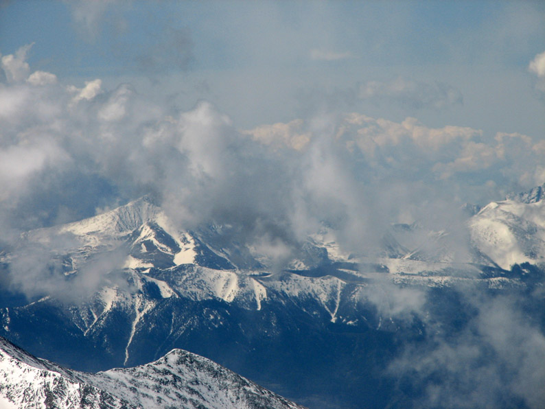
Looking back down to the west, we could see far across the San Luis Valley.
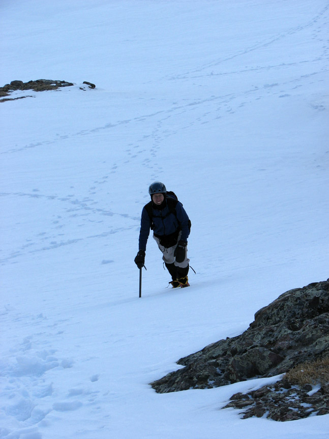
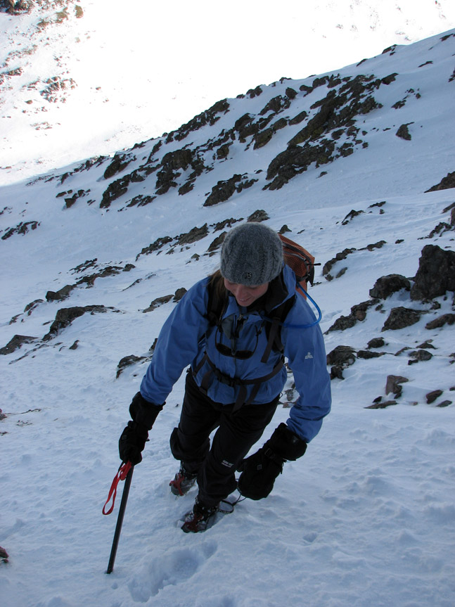
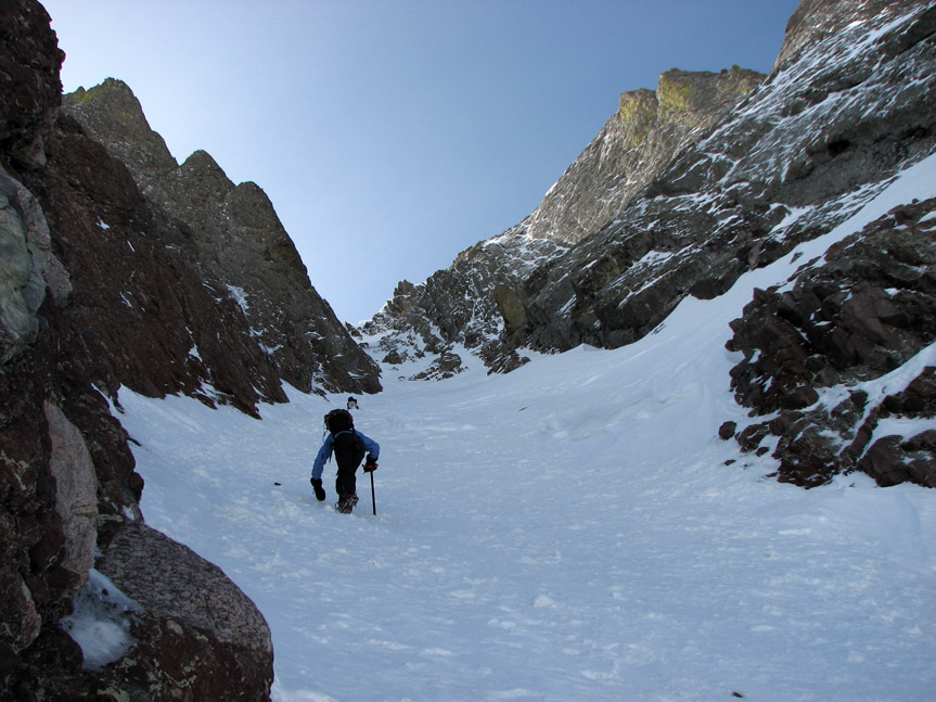
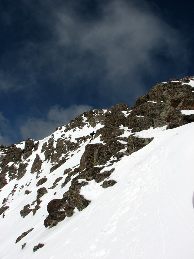
Jonathan takes a breather from crisscrossing up the steep snow. And this is the easy part!
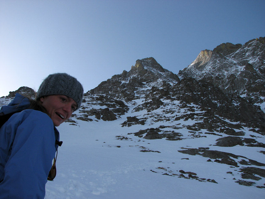
Ali breaks out into a smile - today we are living the high life!
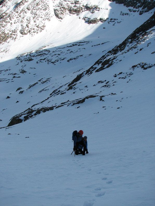
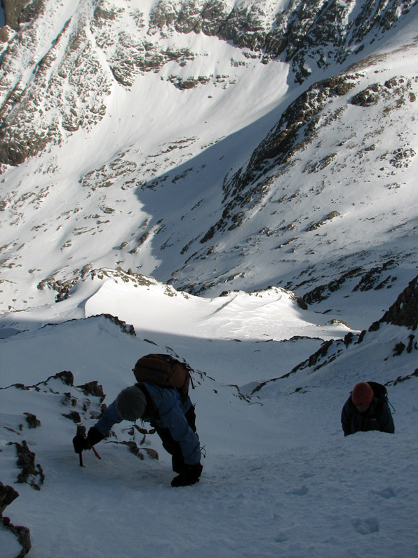
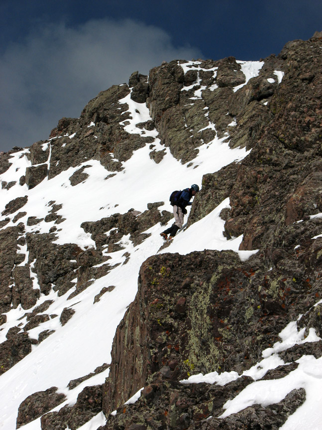
Eric helps Ali for a moment - the valley is starting to drop away due to the steepness.
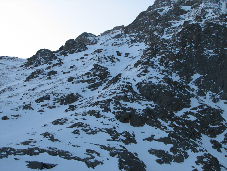
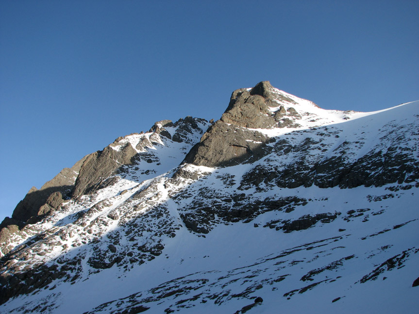
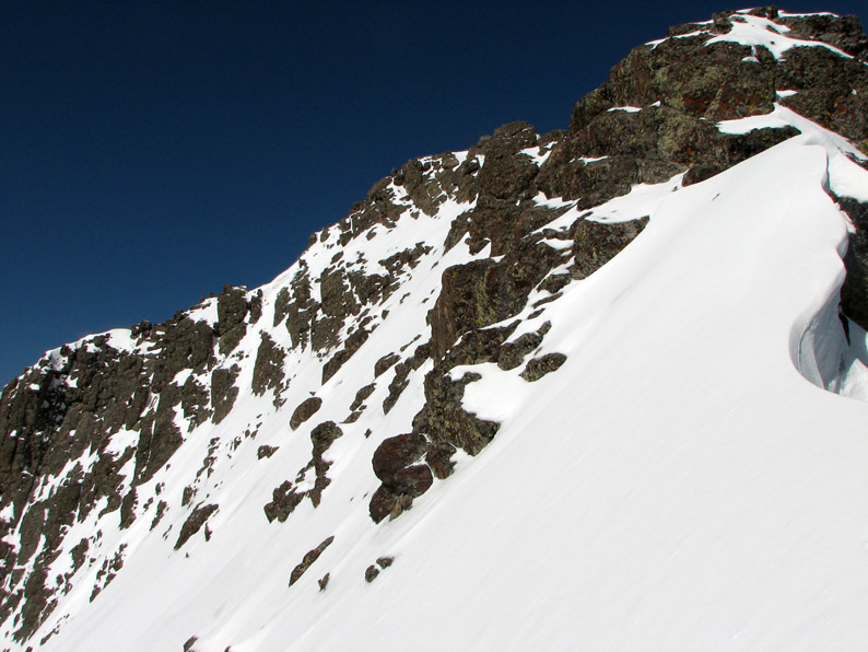
Soon the snow became very steep - and we saw why the guidebook recommended going further left - there were some scary looking cliff bands straight ahead.
Up until this point, this had been a fairly benign snow climb, but now things were getting tricky. We were starting to feel that a slip could turn into a nasty fall. Caution was warranted.
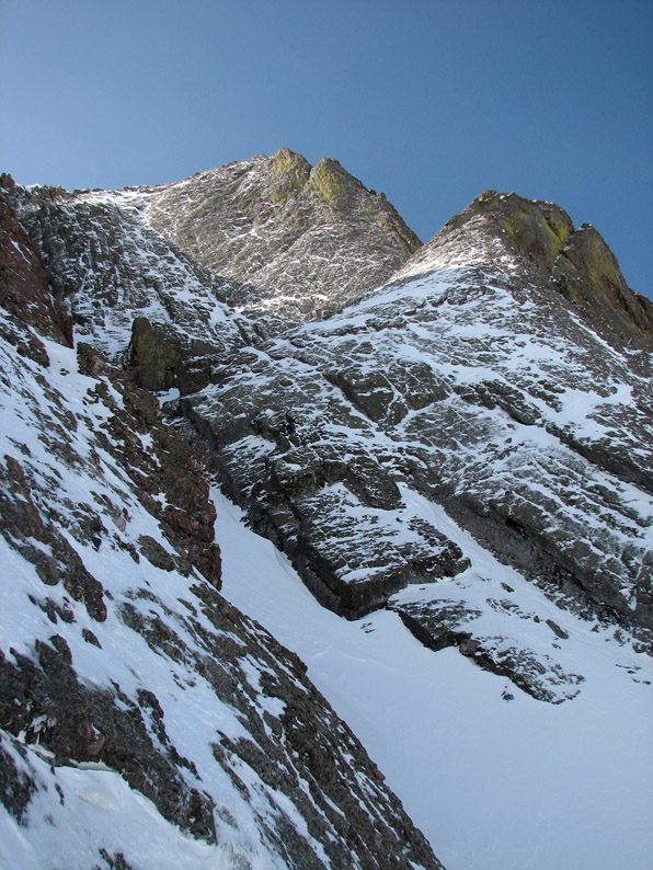
Kit Carson peak loomed with greater and greater perspective the higher we went! We were now seeing views that Lowlanders never see.
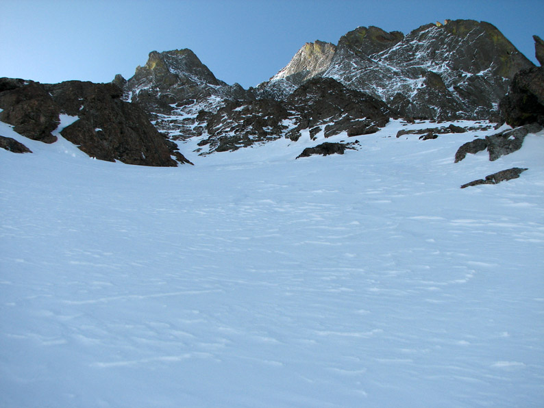
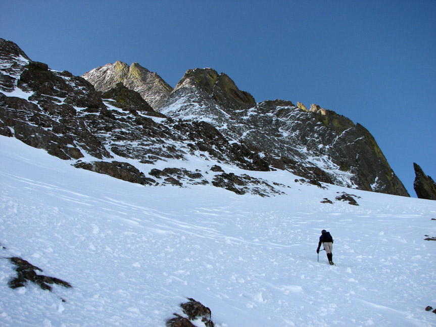
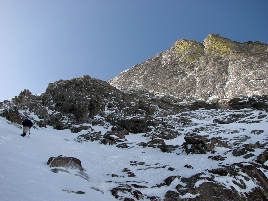
This was the last easy stretch before the couloir. Doesn't look too bad here . . . so far, so good.
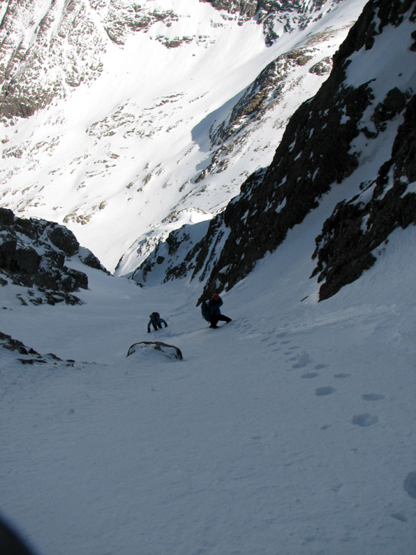
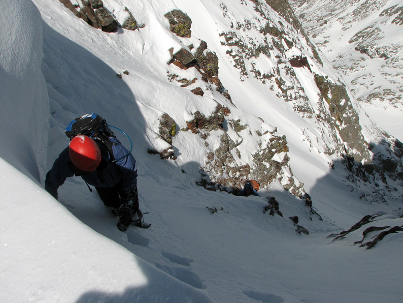
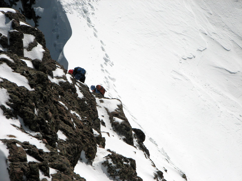
Soon we got into some really gnarly terrain, with scary traverses and sinuous cornices blown by winter's winds. This was not your casual summer 14'er climb. We were doing the real deal! We had to cross a "vague couloir" and got confused for a little while - since we hadn't followed the guidebook route, we weren't sure exactly where we were supposed to find the entry to the real couloir. Soon we found it.
In some places it was too scary to stop and take a picture, we climbed on. We weren't talking very much at this point - each of us were lost in our private thoughts as we traversed this other-worldly landscape with great care.
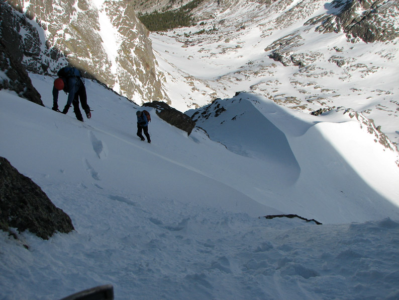
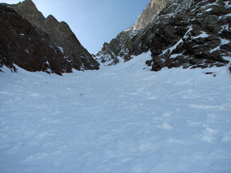
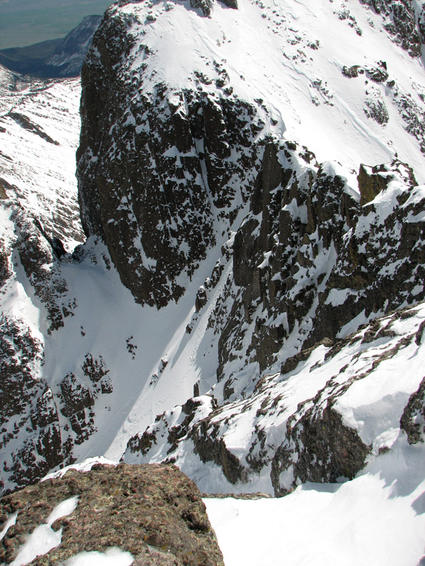
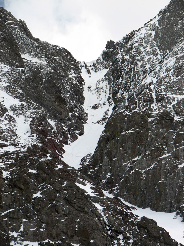
After some tense moments, we reached the base of the couloir - we were at 13,400 feet. The entry point is a small elbow in the couloir - the highest easy entry point according to Gerry Roach.
Our first glimpse was quite impressive - no footprints at all. This probably hadn't been climbed in a while. We had 800 feet of steep snow climbing to reach the notch below the summit.
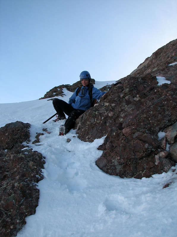
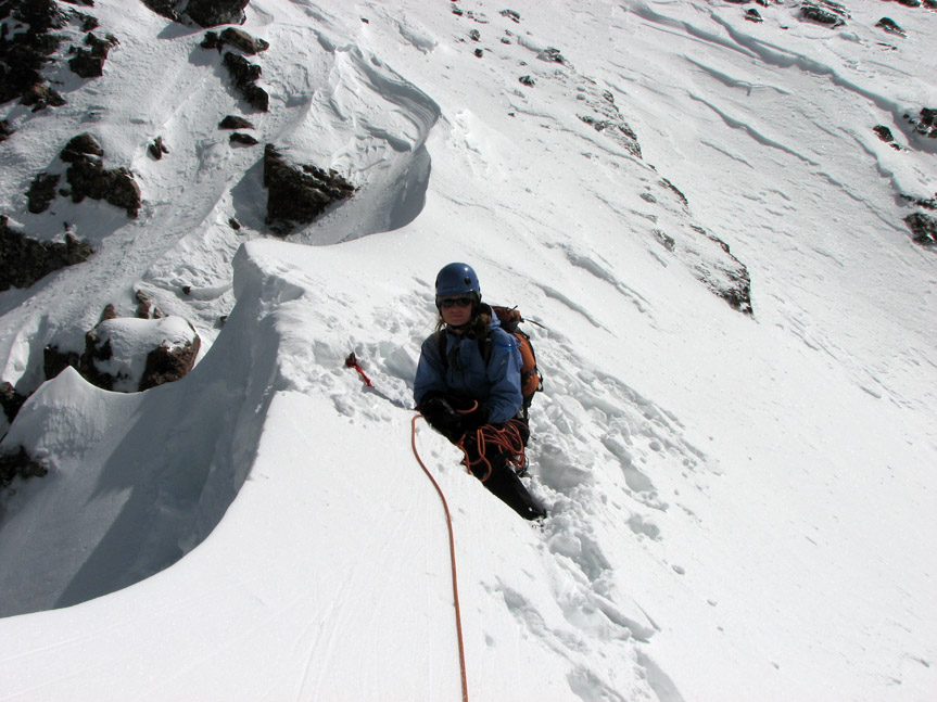
Ali descends a tricky spot to enter the couloir. You definitely would not want to fall here, as an uncontrolled fall would take you down several hundred feet of steep snow, then off a massive cliff.
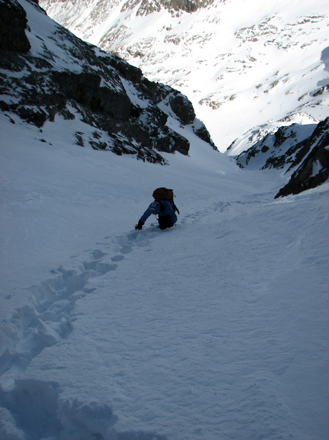
We tried not to think about the huge cliff at the bottom and carefully picked our way upwards. The snow was solid . . . at first. Our crampon points dug in, barely leaving an impression. Then it got softer. Soon we were taking turns kicking steps. The snow steepness was probably about 35-40 degrees.
Soon the snow got very deep - it became hard to make upward progress. Take two steps forward . . . slide one step backward. At this point, we didn't have to worry to much about falling - our legs were sinking deep into the snow.
As we got higher, the slope steepened even more - maybe 45 degrees.
Looks steep, doesn't it? Slope not exaggerated!
We ascended through a cliff band at the very top of the couloir (maybe 50 degree steepness) and reached the red notch (E. 14,180 feet) with great relief at 9:35 AM.
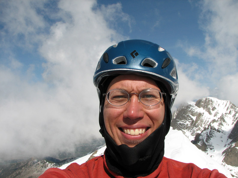
Here's a spectacular shot of Eric cresting the notch.
The views from here were simply incredible. This was Spring climbing in the Rockies at it's best.
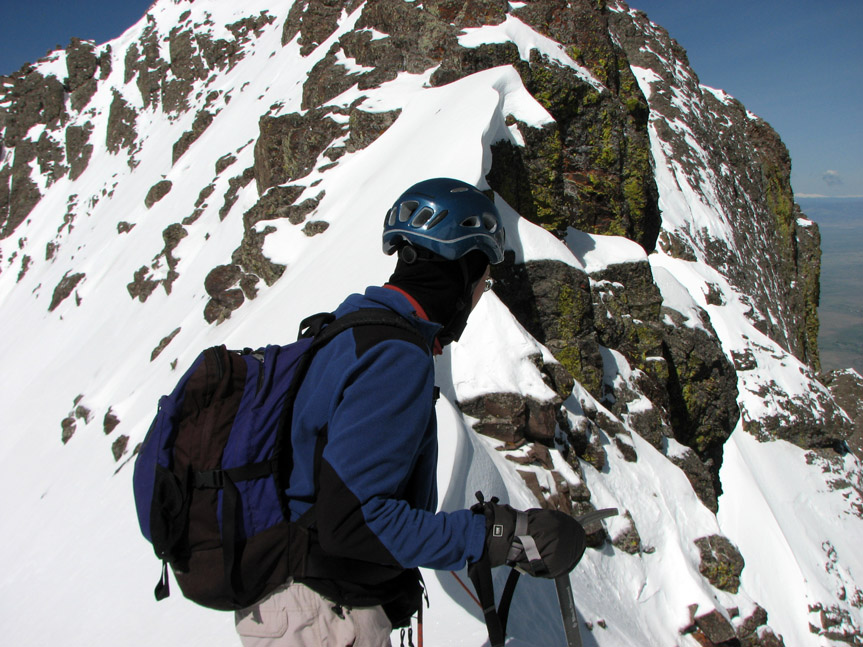
I am watching as Ali climbs up into the Notch. Behind me is the summit ridge. Rather imposing! In the summer, one might go straight up. But the drop off on the right was considerable!! I elected to traverse left on the sun-baked snow. This turned out to be pretty scary as well.
Looking south, we could see the Great Sand Dunes National Park.
From the notch, there was a fairly flat stretch - looking across this one spot, you might imagine that you were not standing at the top of a high peak, but just looking across a big snowfield. Looks can be deceiving . . .
For me, this was the crux of the entire route - a hair-raising traverse across a cliff band and rock slabs covered with several inches of sun-baked slush. This was far from ideal climbing snow. Even though I was wearing crampons, the slush offered no real traction - I had to carefully let my front points grab the rock slabs beneath - rock that I couldn't see. Each step was perilous. But we had spent 3 days, one failed summit attempt, and now we were within just a few hundred feet of the summit. Why stop now? I carefully considered my future. If I slipped, I could possibly slide more than 1000 feet down the south facing couloir, which also had a cliff at the bottom. I figured I would have quite a while to self arrest on the sun-baked slush. No problem, right? At the worst, I would just turn into a gigantic snowball as the slush stuck to me. A fall probably wouldn't be fatal, I thought. And the summit was so close - almost within reach! Against this calculus I weighed my desire to one day get married, have kids, watch them grow up, and enjoy a long and prosperous career. Through my mental fog, the summit beckoned . . . and I answered. Maybe the above is a bit of hyperbole, but I just highlight the choice I made here because one never knows the true risks when climbing. Often the risk that gets you is the one you don't see. While I am not a wanton risk taker, I realize that all mountaineering involves some risk. The mountain's job is not to make sure you have a good holiday - it doesn't care. I felt that this situation, while dicey, was probably okay. But who can say. My outcome was successful, but if I had to do it 10 times, or 100 times, I'm not so sure it would have worked out every time.
Here is the view looking back towards the notch - I have just come up from the center of the photograph.
Ali and Eric were a bit skeptical of my daring traverse across the retched snow. They opted for the more solid, but exposed summit ridge. From my perch, I thought they were crazy, but to each his own :)
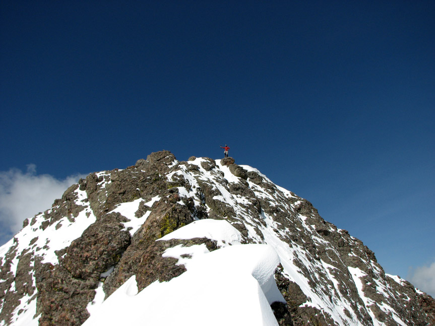
Unfortunately, this didn't pan out for them. Things got pretty scary and they decided that maybe reaching the summit shouldn't be their highest priority today. I was a bit surprised to look back and find that they weren't coming. But I was basically to the top, so I walked the last few steps and reached the summit rock. Success! Summit Experience
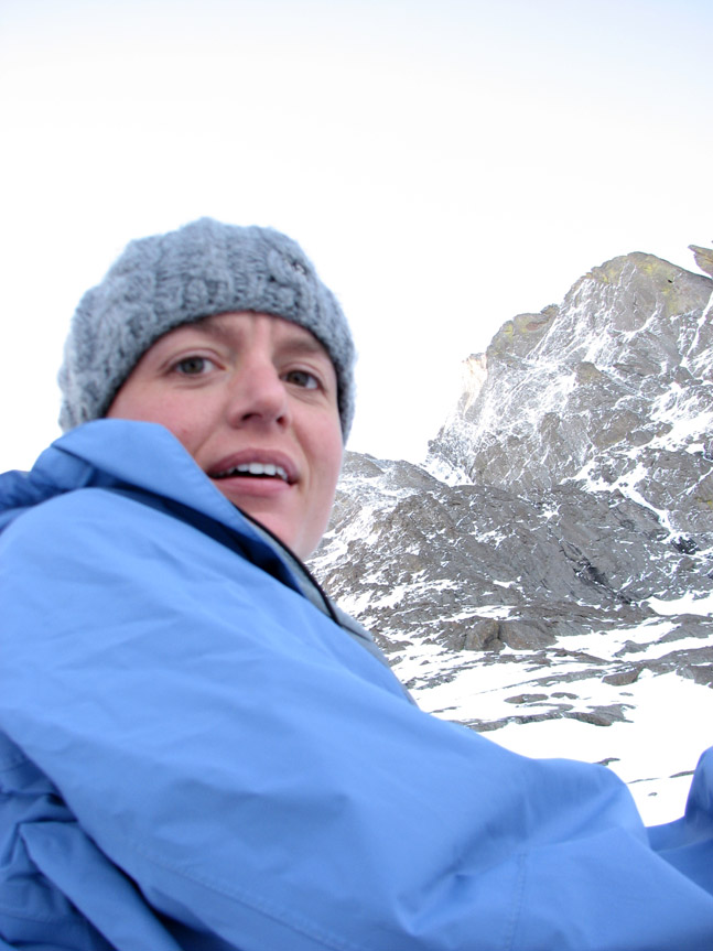
Before I could forget, I snapped a self portrait. There are not many 14'er summits where I have been the only climber to visit in several days - this was a truly special occasion. But I would have rather shared it with Eric and Ali. The time was 9:50 AM. It took us 3h50m to summit from base camp, a climb of 3400 vertical feet in 1.8 miles. But there are less tangible things about summits than statistics - this summit was simply breaktaking!
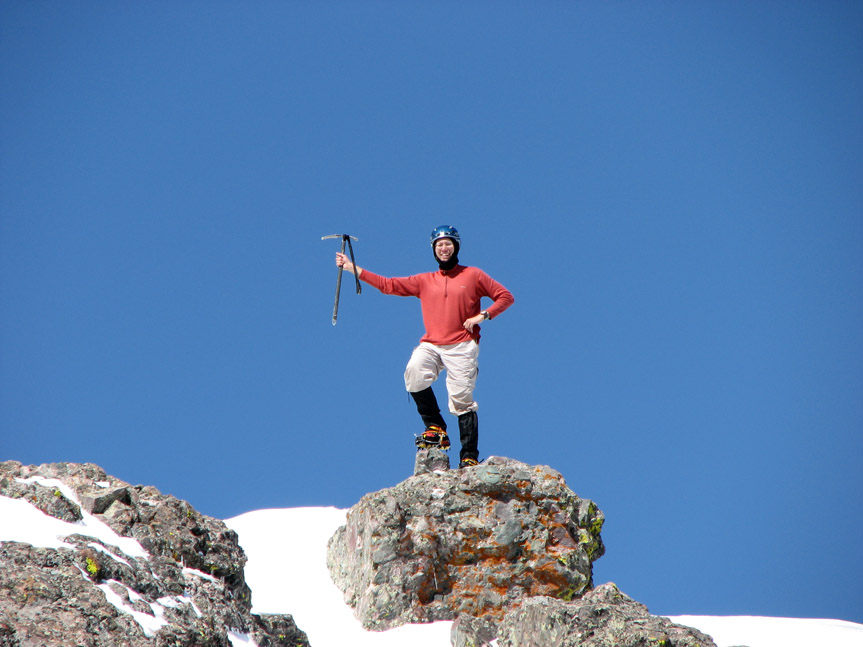
Because they didn't summit, they captured this unique shot of me on top (thanks Eric!).
Here's a closeup. Man conquers mountain . . . this time.
The views were stunning. I have done very few 14'er ascents in winter conditions and the memories of this climb will always stick with me.
Although it was only 32 degrees, the intense sun made it feel as if it were 80 degrees! Clouds were starting to waft up to our level - the atmosphere was starting to go convective.
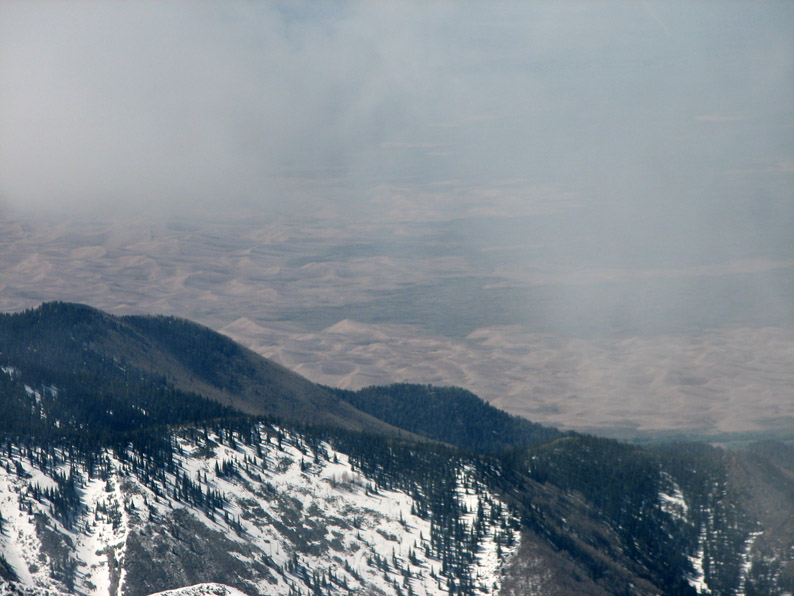
Here is a close-up shot of the Great Sand Dunes. These are the highest dunes in North America, reaching up to 700 feet. However, from 6000 feet above they look pretty puny.
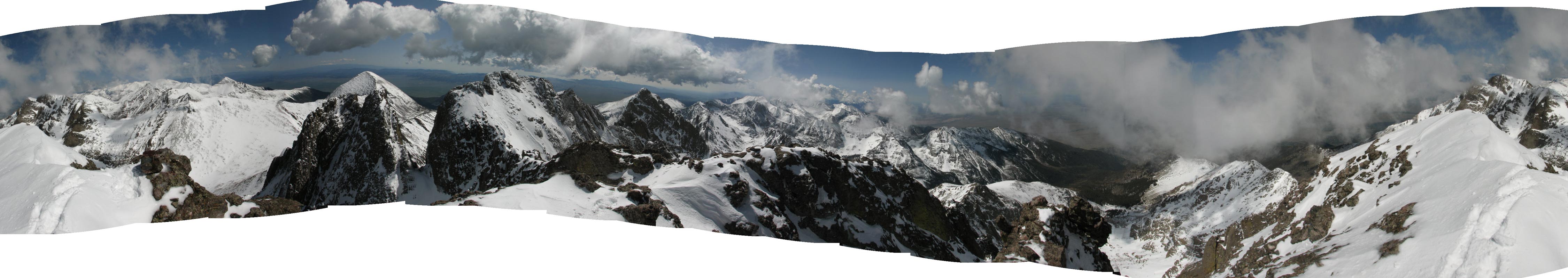
Here is a shot looking down the couloir that we climbed up. If you look closely in the center, you can see our footprints to the right of the rock rib. To get the full immersive summit experience, I've prepared a 360 degree panorama (prepared from 17 images): N E S W N
Click on the panorama to see the full size [844 Kb]. Here is the uncropped version:
Click on the panorama to see the full size [437 Kb]. Descent
Time was passing - after about 16 minutes on the summit, I headed back to the notch, leaving at 10:06 AM. Ali and Eric had the nerve-wracking task of watching me traverse back down. If you look closely, you can see me in the center of the photograph.
Yep, if it looks scary, that's because it was. But the alternative was to just sit at the top of the mountain until the snow melted. Once you're at the top, you're committed! There's no Cog Railway to take you back down here!
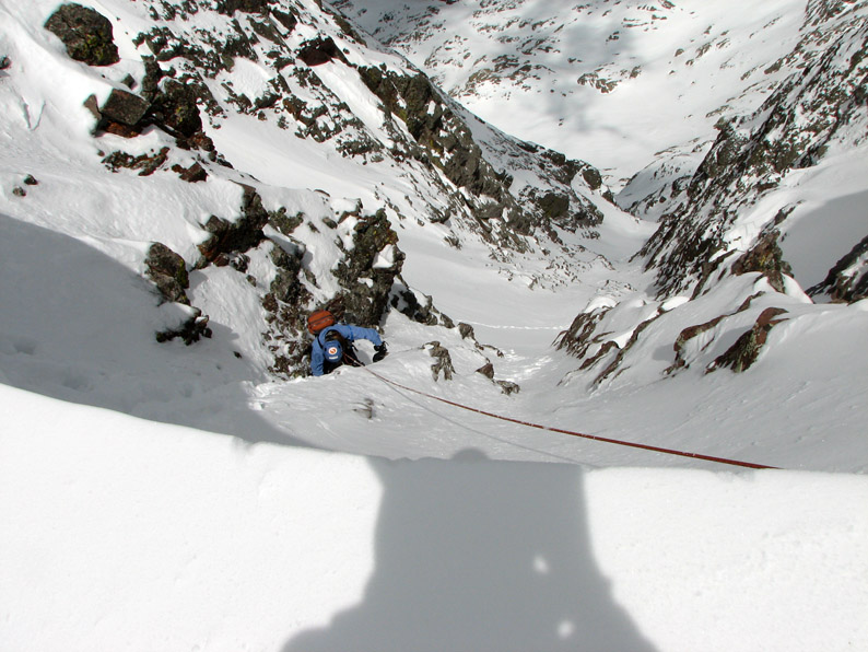
We were all apprehensive about going down the first cliff band of the couloir - Eric had brought his small 9 mm rope, so we set up a deadman's belay by letting the rope cut through the cornice and using a person on the other side as a "dead man" anchor. Eric belayed Ali over the edge.
This took quite a while - I was the "dead man" anchor, and while my body was roasting in the sunlight, my toes were getting extremely cold and got a touch of frostbite. But I was glad to see my friends get down safely.
Once we were past the cliff band, the going became MUCH easier. It was downhill from here! The only thing that could have made it better would have been to have some skis . . . We reached the bottom of the couloir at 11:56 AM.
The lower part felt almost like a big alpine bowl. This would be a fun ski run!
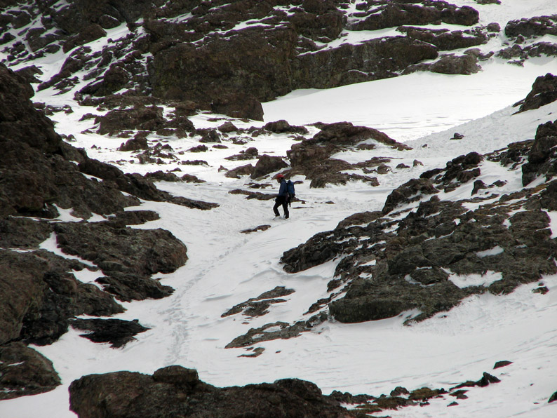
Eric picks his way down the slope - we are almost home free now!
Soon we reached a nice bench to stop and take a rest and grab some food - by this point, we were famished. We looked back at our route - simply amazing!
Can you believe that we climbed up THAT!
If you happen to fall down the bottom of the couloir, this is the cliff you would go off.
Ali and I revel in our success! There's nothing like conquering a difficult peak and living to tell about it! I think it was about this time that Ali said something like: "I don't think I'm cut out to be a mountaineer!". Evidently, this was more than enough excitement for her. I was probably wondering the same thing. I'm not sure what Eric was thinking . . . Well, introspection aside, all's well that ends well :)
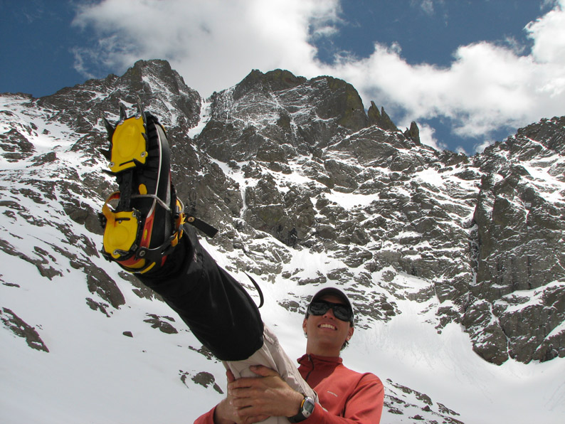
I decided to strike a pose with my worthy adversary in the background. Hooray for crampons! We reached the 12,400 bench at 1:00 PM, ate some lunch, and headed back to camp, arriving at 2:20 PM. We quickly packed up and headed down to the truck.
We crossed through a tangled ghost forest - an old wildfire from years ago. The temperature was warming considerably, reaching the 50's and then the 60's. We kept stripping off clothes. You can tell from our expressions that we were drained by this point. We had been hiking for about 9 hours.
After three days in winter's last clutches, the greenery of the forest was alluring. We felt like we were watching Narnia melt after the 100-year winter!
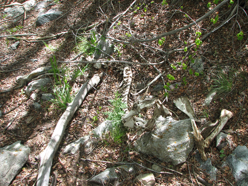
We came across some old bones at one point.
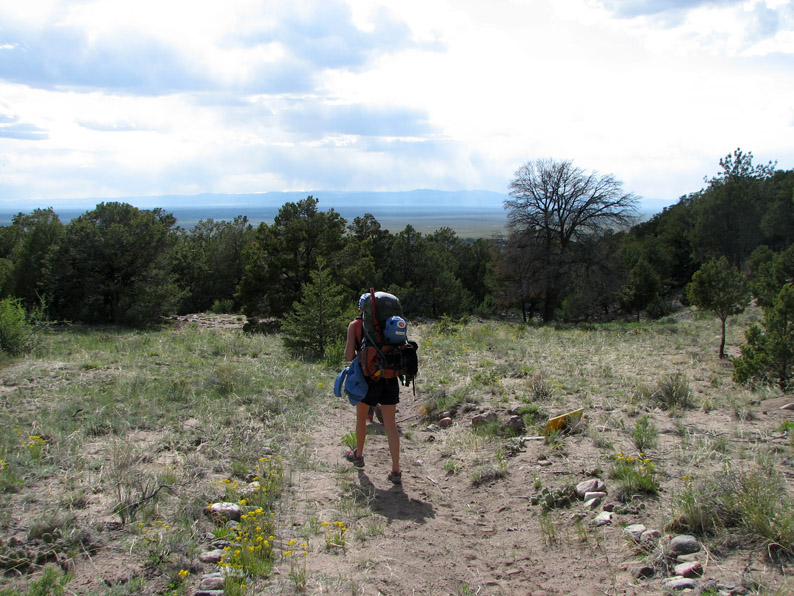
And finally, we reached the desert after descending another 2900 feet and 3.5 miles from camp. It was close to 70 degrees here and felt refreshingly warm.
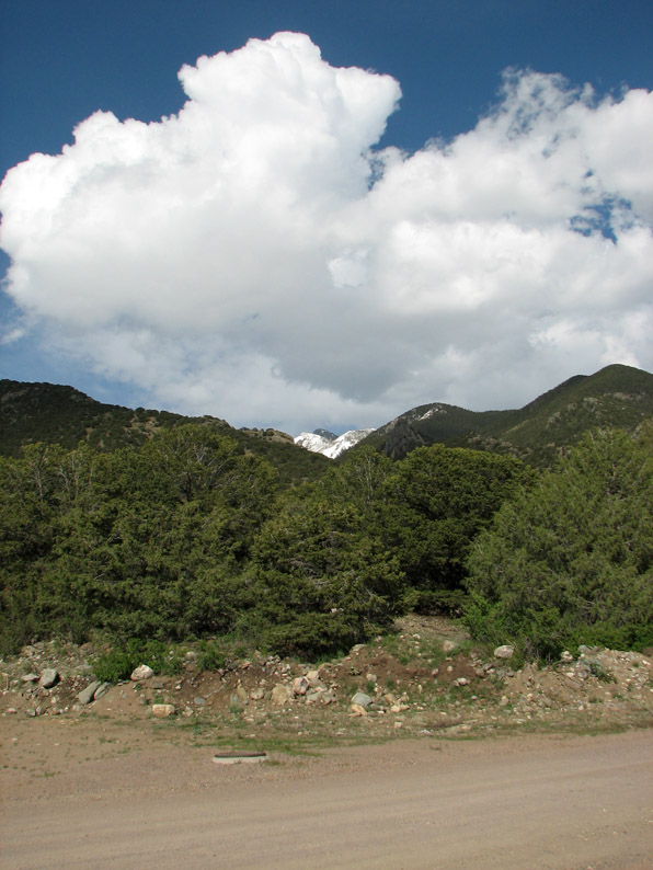
Looking back up the Spanish Creek drainage, we could see clouds building over the peaks. It was good to be back to the trailhead!
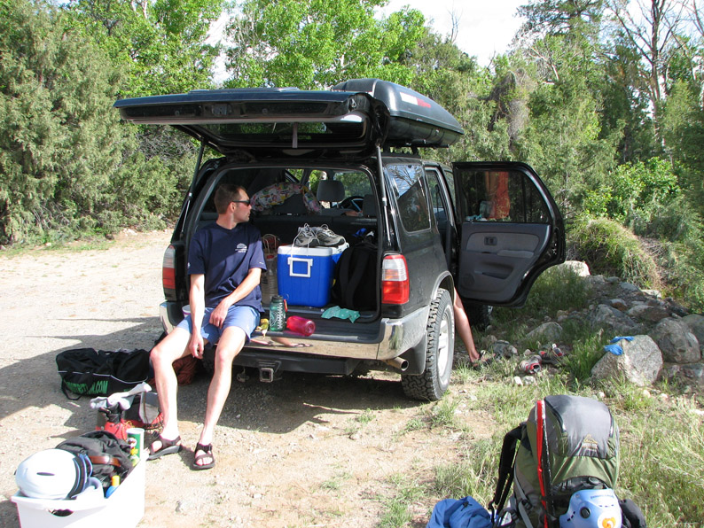
We packed our gear, refreshed ourselves with some snacks, and headed down the road for the next phase of our adventure - some rest and relaxation in the Great Sand Dunes! StatisticsOn summit day, we travelled a 3.6 miles (from camp to peak and back to camp) and climbed a total of 3400 vertical feet in about 8 hours. It took 3h50m to summit, then 4h14m to descend back to camp. To summarize our timeline, we started out at 6:00 AM, reached the 12,400 foot bench at 7:38 AM, reached the base of the couloir at about 8:38 PM, reached the top of the couloir at 9:35 AM, arrived at summit at 9:50, left at 10:06, reached the bottom of the NW couloir at 11:56 AM, down to 12,400 foot bench at 1:00 PM and back to camp at 2:20 PM. The lowest temperature during our climb today was 29 degrees, and the highest (at camp in the afternoon) was 52. The winds were 5 mph or less, with perhaps a few gusts to 15 mph. A perfect day! Altogether, the approach, failed summit attempt, successful summit, and descent totaled 13.6 miles and 7700 vertical feet. Our total hiking time was about 15 hours, for a moving average of 0.91 mph. Spring climbing is not the fastest way to climb a 14'er! This concludes Part II of this trip report. Part III will feature our rather exotic overnight backpacking trip in the Great Sand Dunes, and part IV will feature our climb up Challenger Point. Stay tuned! |
Home | About this Site | Disclaimer || Site Map | Subscribe to be notified when new content is posted to this site
|
Home | About this Site | Disclaimer || Site Map | Subscribe to be notified when new content is posted to this site
|