
Home | Personal | Outdoors | Travels | Blog | Work | Weather | Site Map
|
Home | Personal | Outdoors | Travels | Blog | Work | Weather | Site Map
|
|
|
Home | Personal | Outdoors | Travels | Blog | Work | Weather | Site Map
|
Here is a brief chronology of the fire and acreage (most of this is summarized from the Larimer County Emergency Incident Page for this fire:
2004.03.30 c. Noon Fire reported
1:34 PM Roughly 10 acres in size, fire spreading actively to north up slopes through dry grasses, first responders are on scene
3:05 PM 15 acres, still spreading north through grasses and shrubs, 25 firefighters on scene
6:29 PM 200 acres, some spotty trees involved, burnout operations conducted near Hwy-14.
8:22 PM 350-400 acres
2004.03.31 8:35 AM 500 acres, 40 firefighters on scene, 80 additional firefighters on order, as well as a air tanker and a Type II management team. Heavy smoke up and down the Front Range, some gusty canyon winds (up to 33 mph) in morning.
12:36 PM 700-750 acres, two helicopters assisting, Hwy-14 closed. Fire becoming plume-dominated.
4:04 PM 750-800 acres, fire burning actively (strong smoke plume), spreading mostly north and northwest, has reached Gateway Park area near Seaman reservoir.
7:30 PM Perimeter Map of Fire
2004.04.01 8:36 AM 1800-2000 acres, fire still burning mostly to north and east, some containment on southern lines. 80 fire fighters stationed nearby as well as several aircraft. Gusty winds are expected to cause challenges today, and a cold front will bring a wind shift tomorrow, as well as the possibility of rain/snow.
10:41 AM Fire continuing to burn very actively, and is now at least 2000 acres. The Bonner Peak subdivision is being evacuated. Winds have gusted as high as 35 mph this morning.
11:07 AM Fire has experienced a 'blow-up', with large smoke plume billowing upwards. A small pyrocumulus cloud was noted a few minutes later.
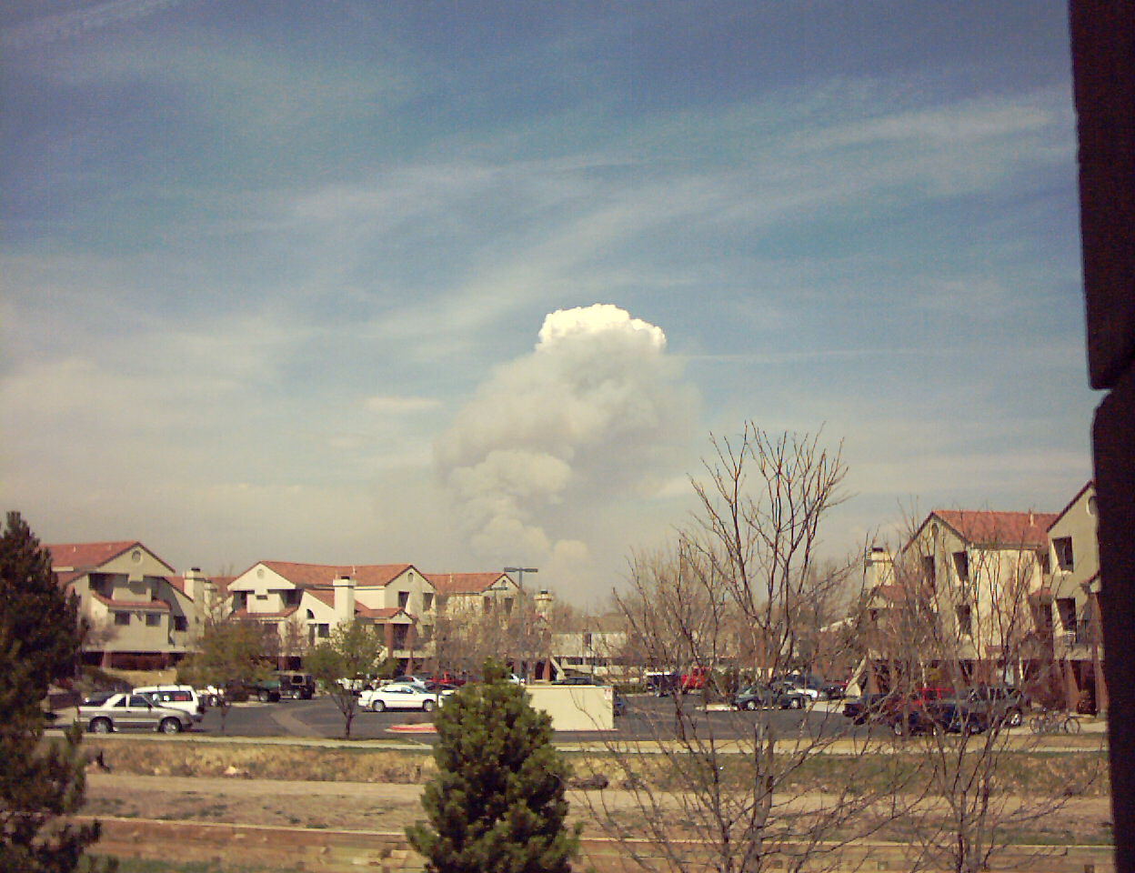 Fire at about 11:07 AM
 Fire at 11:13 AM
The CSU Department of Atmospheric Science webcam just happens to be pointed almost directly towards the fire. Brian McNoldy has created a loop of the current webcam images, which can be viewed here.
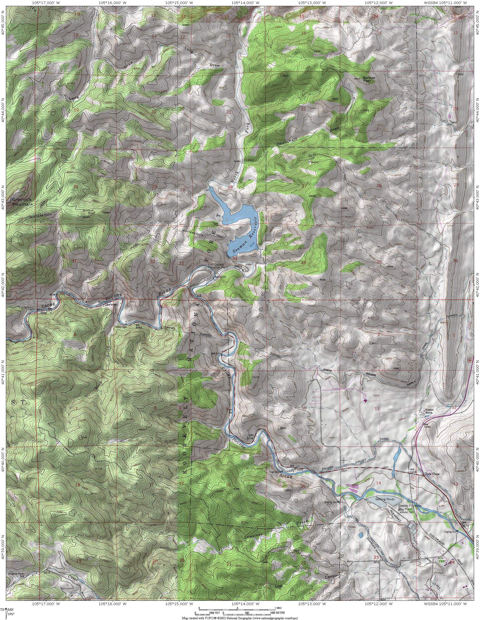 Topographic and vegetation map of the fire area [1.6 MB]
Home | About this Site | Disclaimer || Site Map | Subscribe to be notified when new content is posted to this site
|
Home | About this Site | Disclaimer || Site Map | Subscribe to be notified when new content is posted to this site
|