Topographic Visualizations of the Skisonde Routes
The following maps and visualizations were created using
National Geographic's TOPO! software (Colorado State Series) and expansion pack
(Streets and 3D Views). The primary skisonde routes are illustrated in red
(full-mountain sounding), green (intermediate mountain sounding), and yellow
(backside of mountain sounding). These routes correspond to the skisondes taken
by Jonathan Vigh. In most cases, the skisondes taken by Mike Smith closely
correspond to these routes.
2D Overview of the Entire Mountain
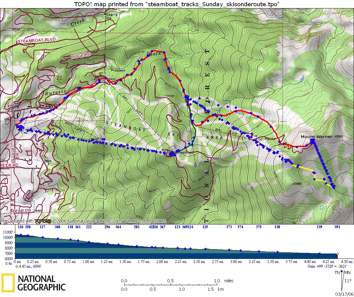
This map shows the three main skisonde routes used during
this field project. Routes (indicated by solid lines) are drawn freehand based
on the GPS waymarks recorded during the observing period (9:30 AM - 11:45 AM,
February 26, 2006). Waymarks without marked routes generally indicate the lines
of the gondola and chair lifts.
The full mountain sounding is indicated in red.
The intermediate mountain sounding is shown in green.
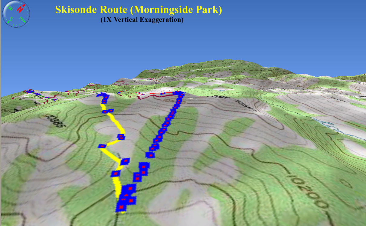
The backside sounding route is shown in yellow.
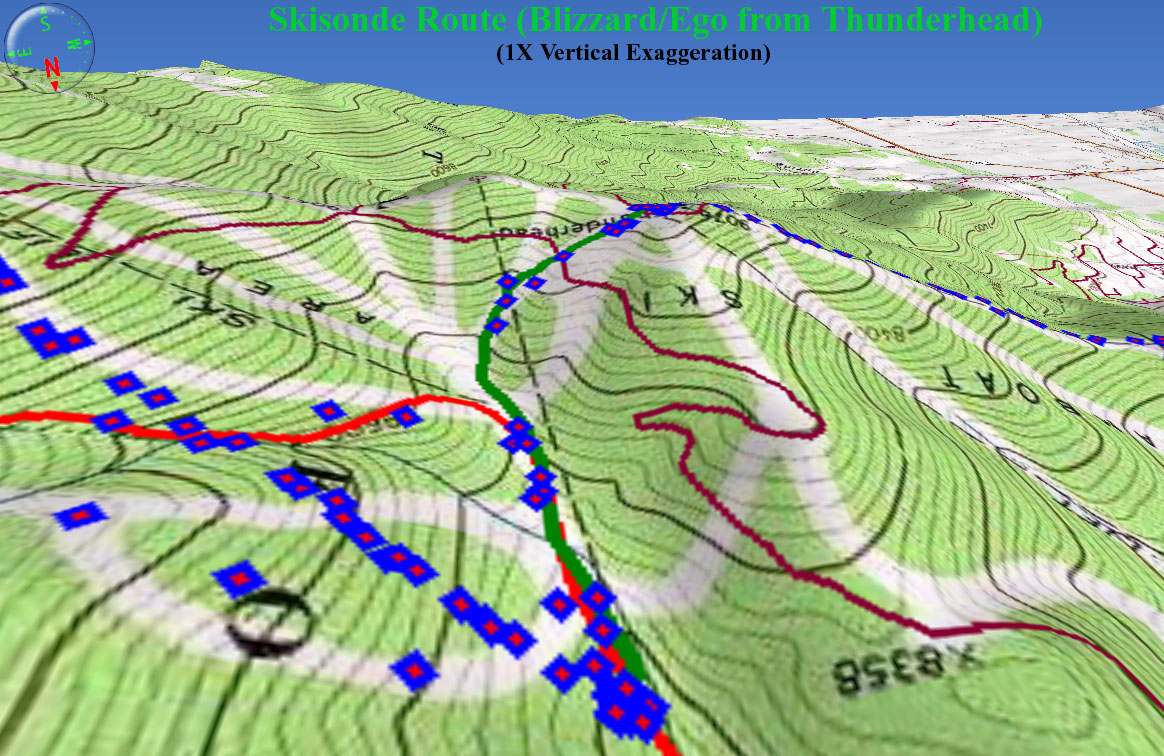
One of Jonathan Vigh's (10:54 - 11:07 AM) full-mountain
soundings took a slightly different route on the upper part of the mountain.
This skisonde started from the top of the Storm Peak Express: Storm Peak North
-> Four Points Hut -> Cyclone -> Tornado Lane -> Ego -> BC Ski Way ->
Right-O-Way -> Base.
3D Overview of Full Mountain
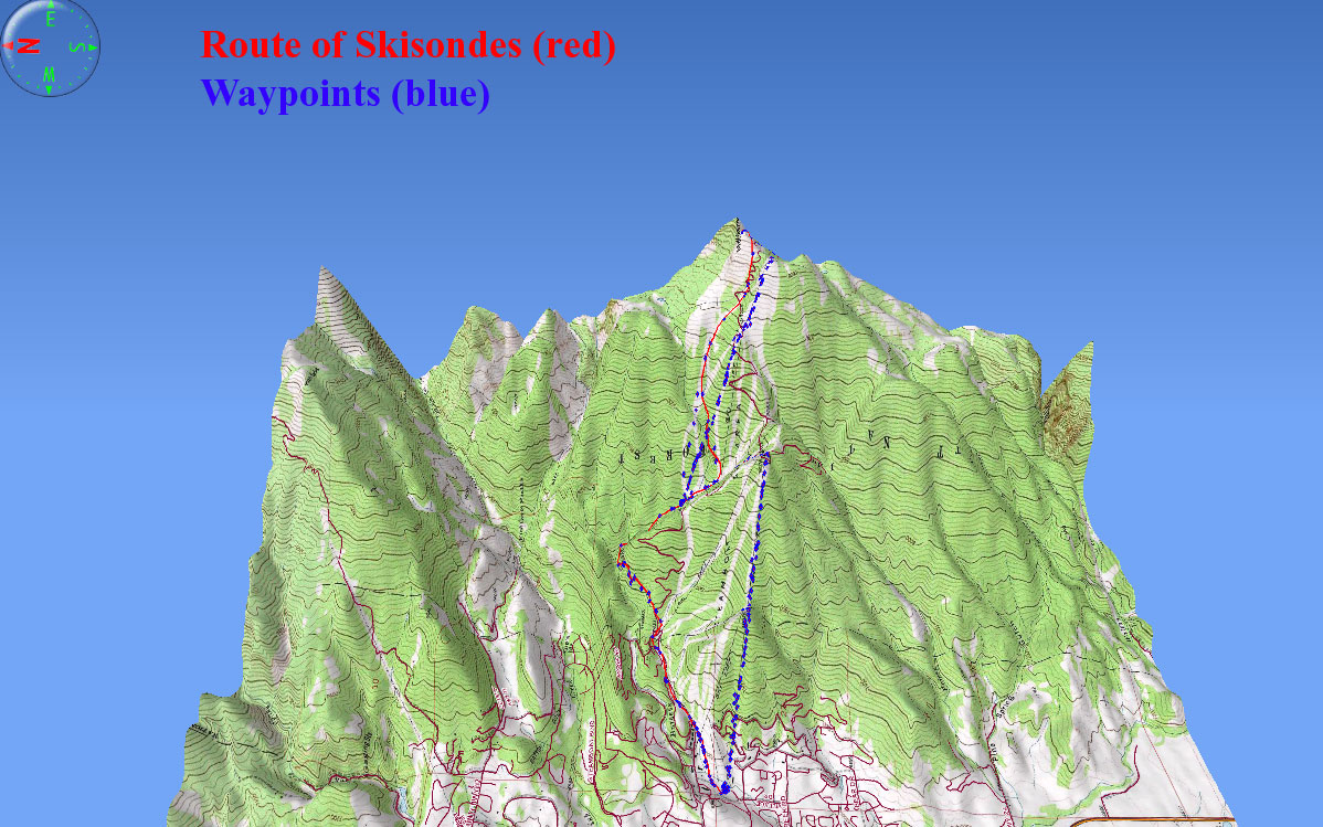
This view looks down and to the east from a point several
miles west of the ski area.
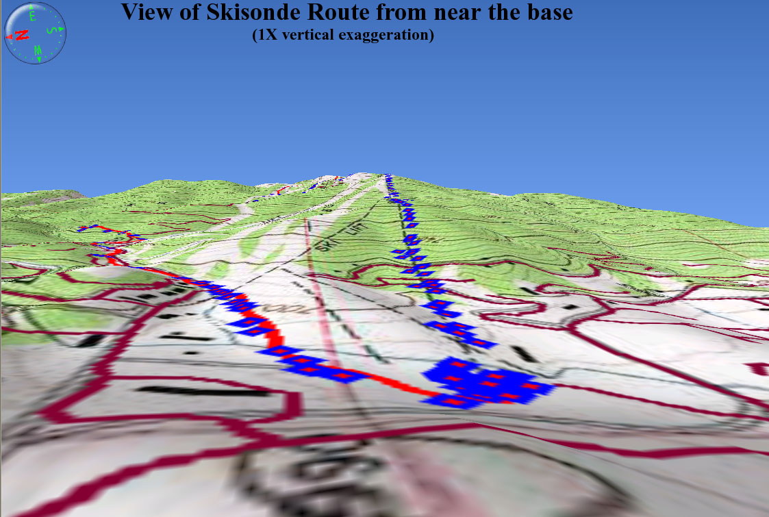
3D view from near the base, looking up and eastward
3D view looking from Thunderhead (top of the gondola) down
and towards the northeast.
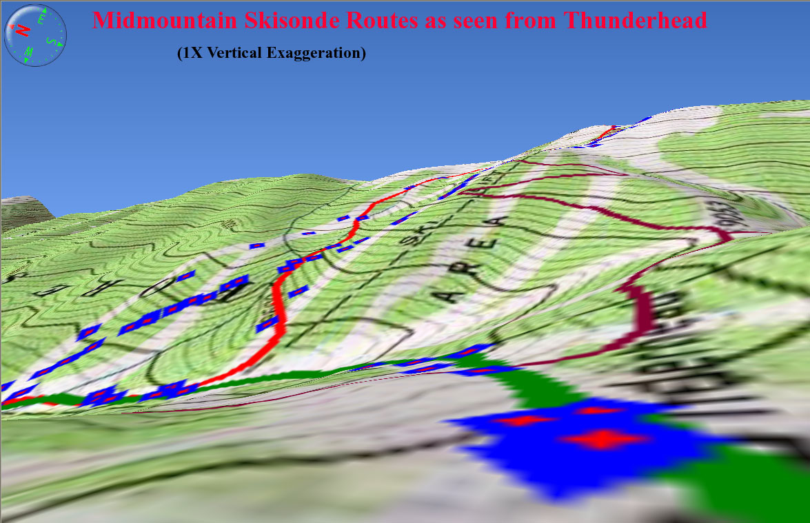
3D view of mid-mountain area, looking down and to the south
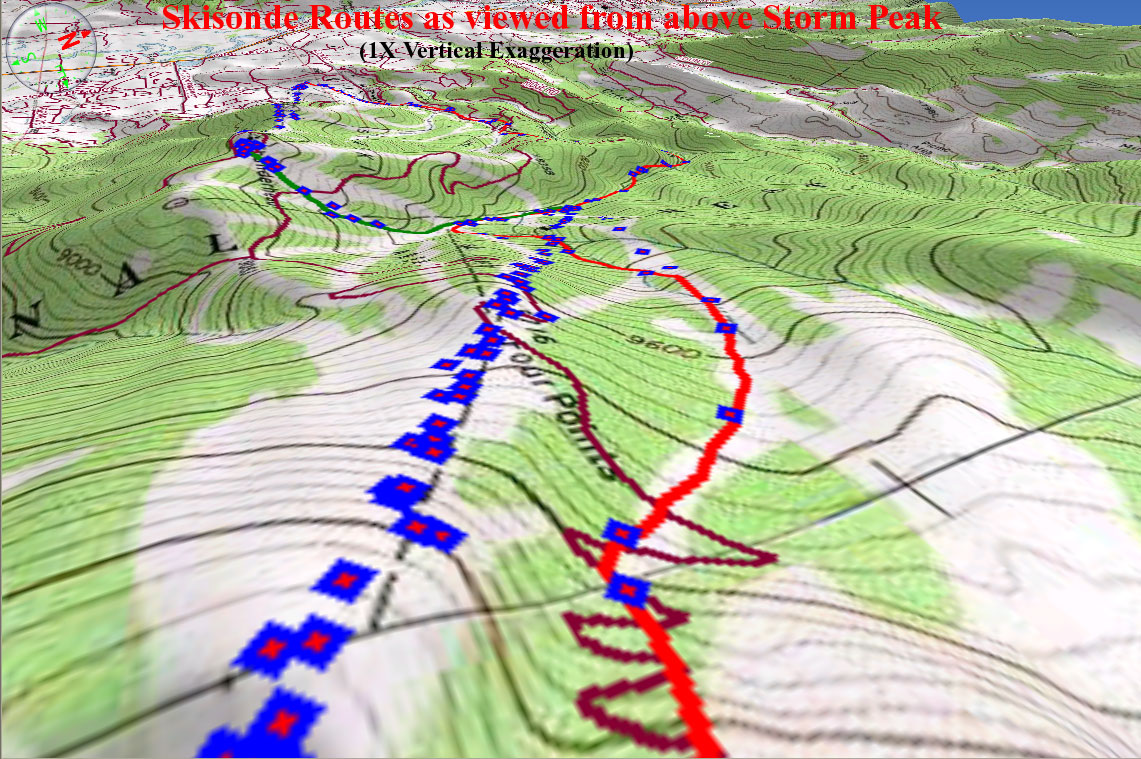
3D view looking NW from above Storm Peak
3D view of the backside sounding route
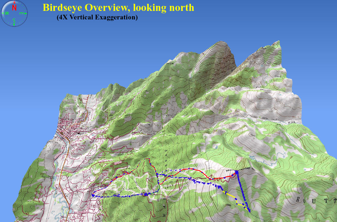
Vertically-exaggerated 3D view of entire area, looking north
from a high altitude
This page has been accessed  times
since March 17, 2006.
times
since March 17, 2006.