
Home | Personal | Outdoors | Travels | Blog | Work | Weather | Site Map
|
Home | Personal | Outdoors | Travels | Blog | Work | Weather | Site Map
|
|
|
Home | Personal | Outdoors | Travels | Blog | Work | Weather | Site Map
|
Trip report written by Jonathan Vigh, posted Feb. 6, 2005 (I still have a few things to tweak, like stitching the panoramas)
Fellow adventurer: my mom, Susonya Vigh
My mom and I did this Grand Canyon hike as part of a vacation road trip throughout Colorado, Utah, Arizona, and Idaho in July 2003. The day before this hike, we drove over from Page, AZ to the North Rim. On the way into the park, we passed through an area which had just been hit by enough hail to turn the ground white. An eerie fog hung over the ground near the park entrance, and the temperature was down to about 52 degrees! Pretty chilly for a midday temperature in mid summer in Arizona, this reminded us that the Grand Canyon's North Rim is at the rarified elevation of 8000 feet! We took an auto tour out to Point Imperial, at 8803 ft, the highest point on the North Rim. We also stopped at sublime Cape Royal (El. 7865 ft) and gawked at the awesome views of the inner gorge and Colorado River 6000 feet below (I'll post some of these panoramics when I get around to it). That evening, we took in the sunset at the Grand Canyon Lodge and watched a distant thunderstorm put on a light show to the southeast.
That night we lodged in a rustic cabin. Since I was training for the Pikes Peak Marathon at the time, I had hoped to do a long hike during this trip. What could be a better hike than hiking down into the Grand Canyon? The National Park Service strongly advises people not to try to hike down to the river and back to the rim in one day, especially during the summer. Most people fail to consider how hard it will be to hike back out, since the initial hike into the canyon is relatively easy and quick. When hikers turn around, the increased exertion of going uphill, brutal heat, and increasing altitude often prove to be a grueling and dangerous combination, necessitating many rescues and sometimes leading to heat stroke or worse. To hike all the way to the river and back from the North Rim is much more than just a typical endurance hike; with a total distance of nearly 30 miles and a vertical gain of 6000 feet, it is more like an ultra hike. In light of the summer heat and the fact that we weren't superhuman, we decided to just hike a bit over halfway down from the North Rim, to Roaring Springs (El. 5200 ft), and then hike back out the same day. This would be perfect for a long training hike, with a total distance of 10 miles, and a total vertical climb of 3600 feet.
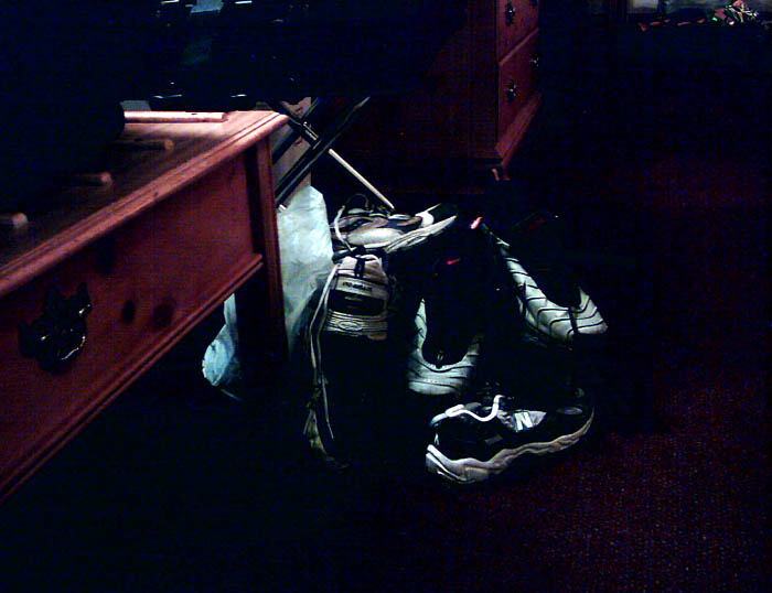
Even though we were only going to hike halfway down, I took great respect of the hike and compiled the gear pile shown below. It consisted of 16 servings of Gatorade, some Gu energy gels and other salty snacks, 140 oz. of water, an extra pair of socks, small digital Aiptek camera, sunscreen, sunglasses, and bandana (to use for keeping cool). My mom packed a pack with similar items. We tried to get to bed early, but it was uncomfortably warm, so I didn't sleep very well (I rarely sleep well the night before an exciting hike or race).
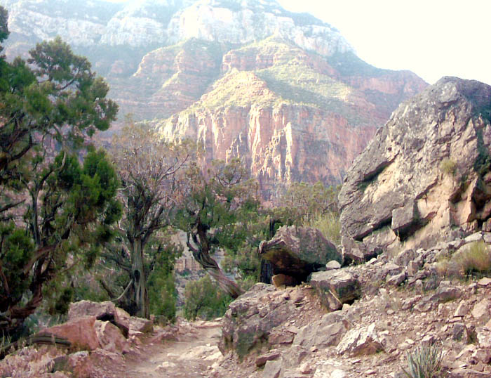
We awoke at about 4:30 AM, ate a breakfast of oatmeal and fruit, then headed to the North Kaibab trailhead which was just a few miles from the Grand Canyon Lodge. The trailhead starts at the stately elevation of 8255 feet above sea level, which is also 5800 feet above the Colorado River. We started hiking at 6:10 AM, which was just about the time of first light. The temperature was about 50 degrees, and a chilly wind was draining off the high plateau into the canyon. The first stretch of the trail was a steep downgrade through the North Rim forest. The trail surface consisted of a bed of fine dust several inches deep and strangely greenish in color -- dust mixed with the droppings of the horses and mules.
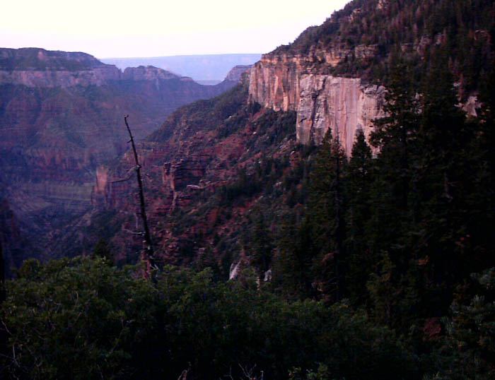
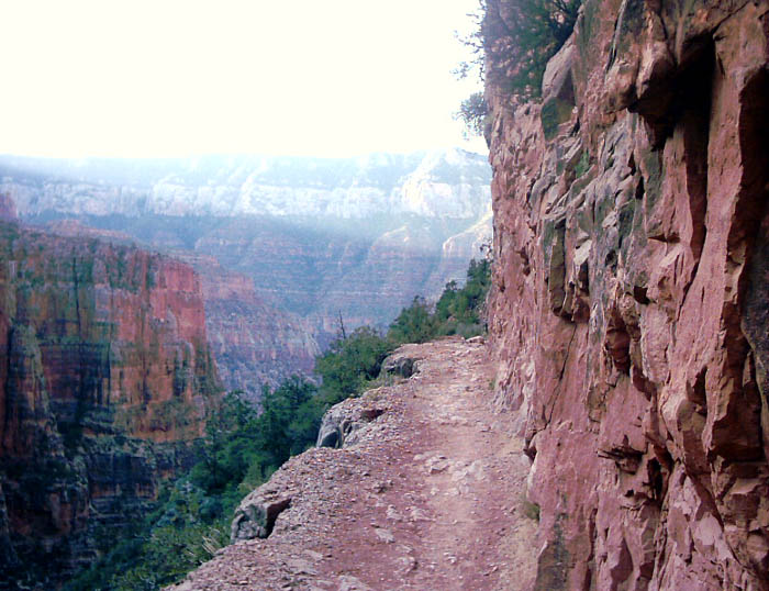
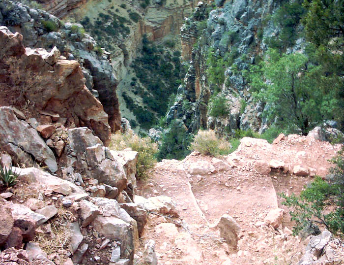
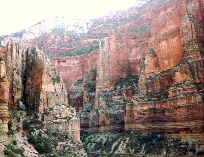
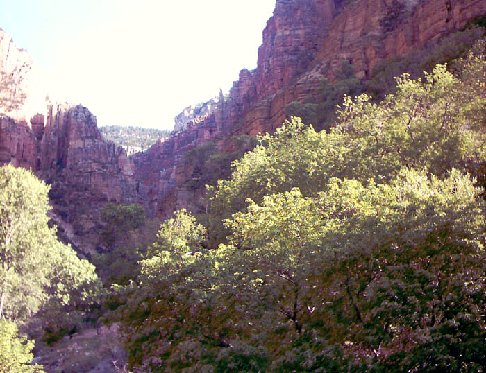
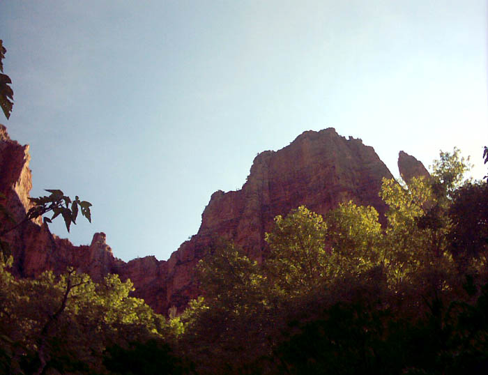
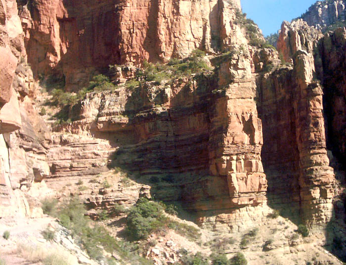
Beautiful views of the canyon soon opened up as the forest thinned and the dawn light increased. We started descending through a gap in the spectacular white cliffs that line the upper canyon on the North Rim. The first point of interest was the Coconino Overlook. After traversing down the cliffs on the cleverly routed trail, it was even more impressive to realize (if I'm remembering this story right) that Powell and his men followed this same route down into the canyon when they were first exploring the area -- in a winter snowstorm and without the benefit of a clever path! As far as I could tell, the route descends through the only easy break in the cliffs, and as you'll see from the pictures, this is not real obvious.
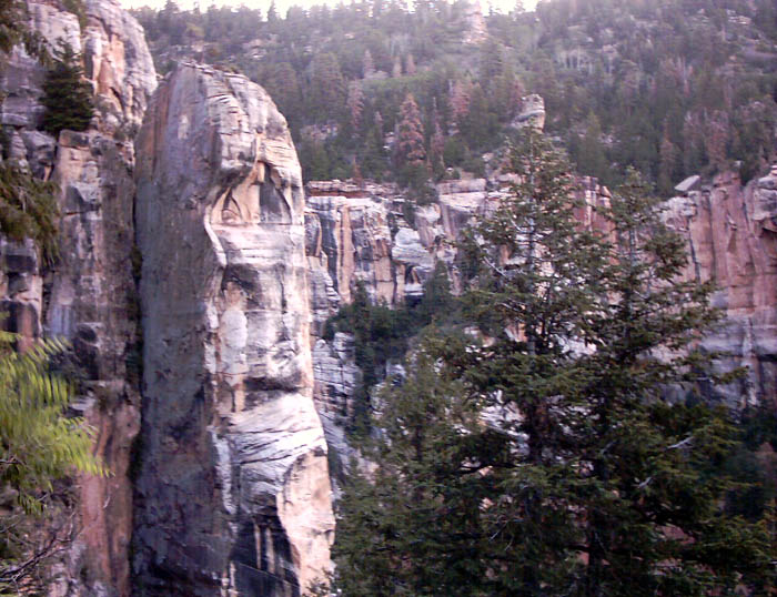
Another picture of the white cliffs. Notice the verdure of the North Rim -- the forest on the North Rim includes firs and deciduous trees, ferns, and even moss. The North Rim is on a high plateau that sits several thousand feet above the surrounding land, and almost 6000 feet above the Colorado River. Because the winds have to rise in just about any direction to get up to the North Rim, the local climate is quite cool and moist for Arizona. The North Rim receives quite a bit more precipitation than the South Rim, which helps support the lush vegetation in contrast to the dry scrub on the South Rim.
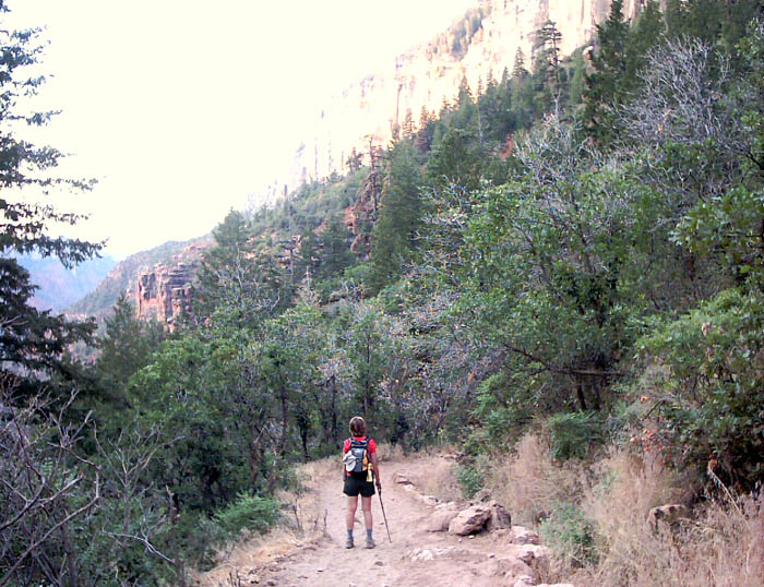
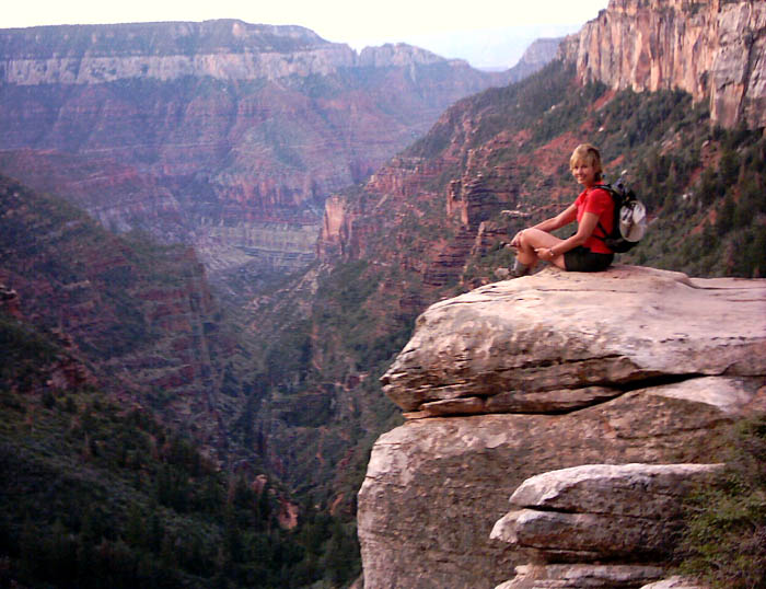
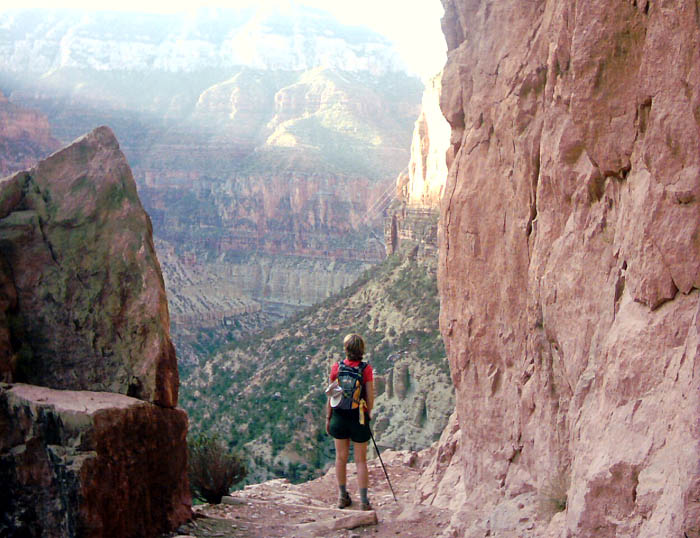
As the sun rises above the canyon rim, the shadows start descending towards the trail. My mom contemplates the view and enjoys the still cool of the morning.
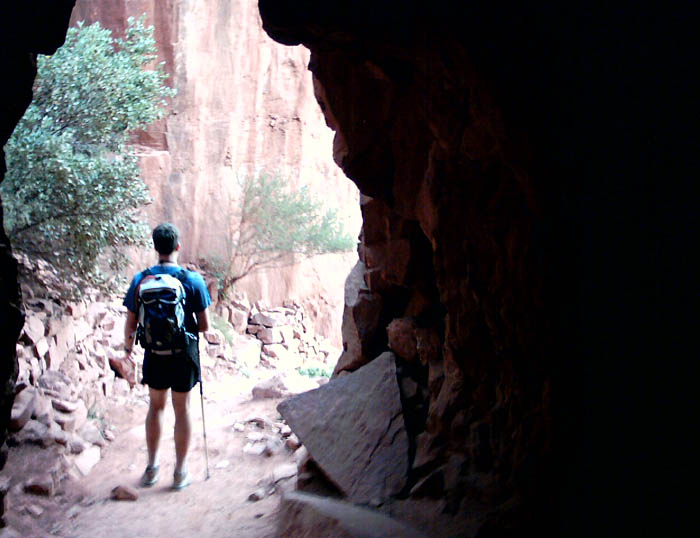
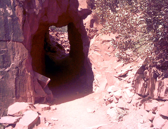
After 1.8 miles, we arrive at the Supai Tunnel, El. 6840 ft. This tunnel was hewn out of the rock to allow the trail to pass through easily. There is a place to get potable water here for at least some parts of the year (check with the Rangers to determine water availability).
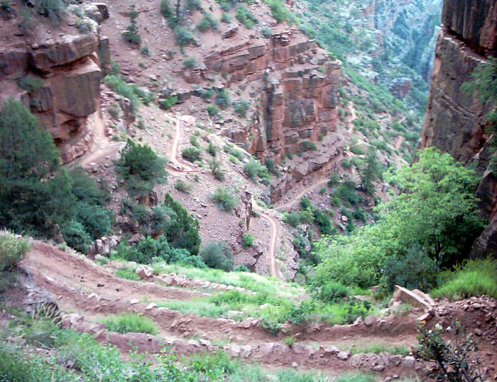
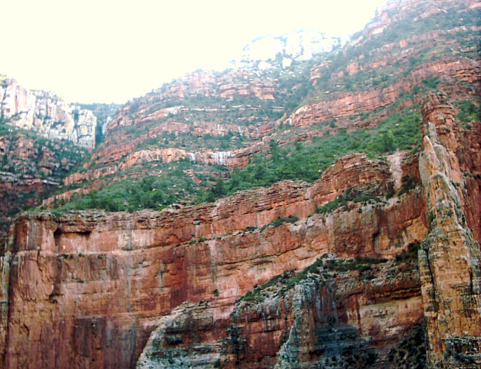
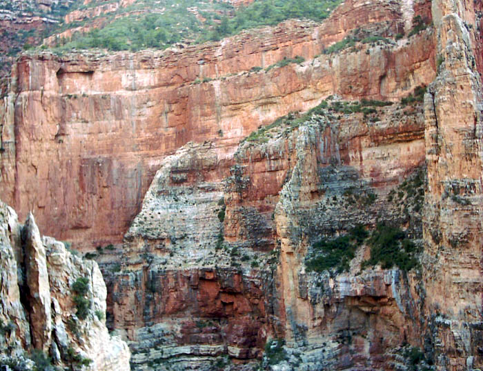
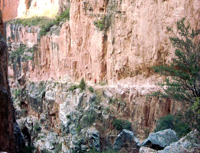
As we descend into the middle canyon, the challenges that were overcome by the trail builders became more apparent. The trail goes down a fantastic series of switch backs. Fun to go down, perhaps a bit tedious to go up . . .
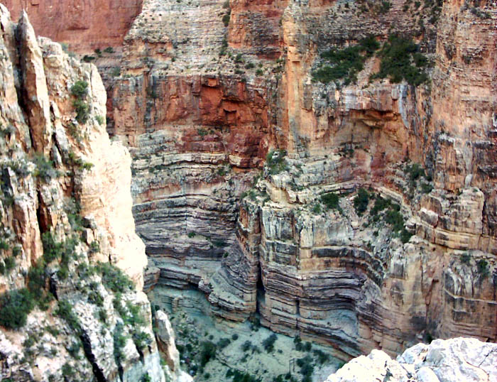
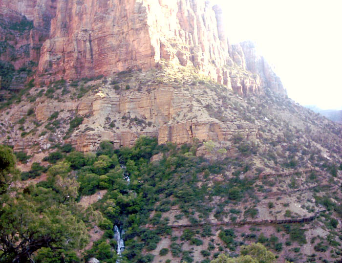
This is the view of the middle canyon from up on the series of switchbacks. Roaring Fork Springs is at the lower part of the canyon in this picture. The lowest point visible in the picture is only about halfway down to the Colorado River!
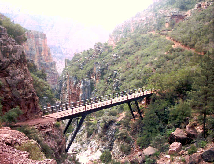
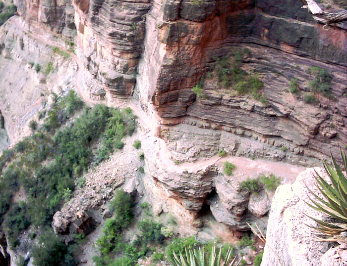
Here we cross Redwall Bridge (El. 6062 ft). By this point, we have come 3.1 miles. The trail crosses the bridge and briefly ascends on the other side seeking a shelf that provides passage past the steep cliffs of the middle canyon.
Here is the afore-mentioned shelf. It is quite passable, although if one were running, he/she definitely wouldn't want to trip.
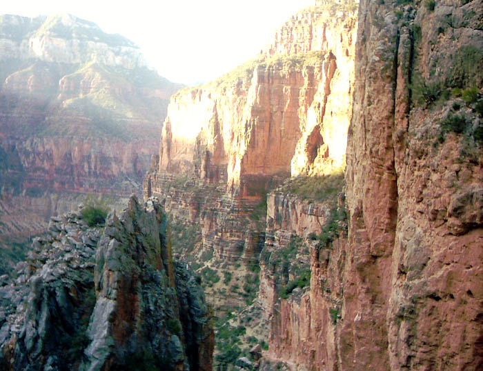
As we descended lower, the shadows continued to chase us. It was still relatively mild -- about 75 deg at this point.
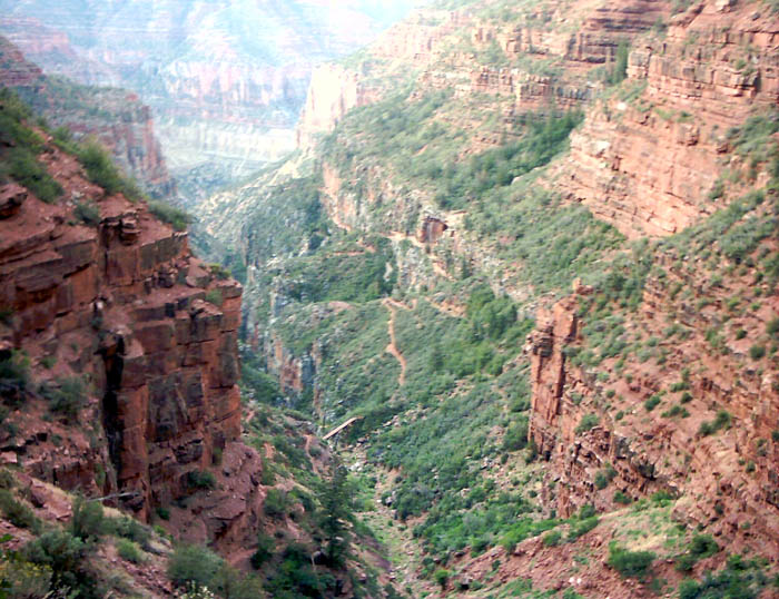
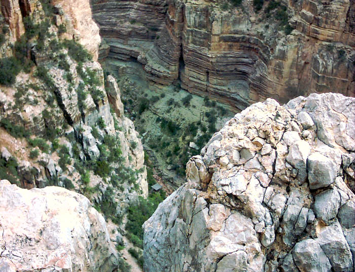
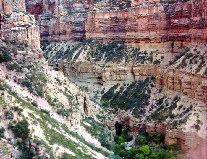
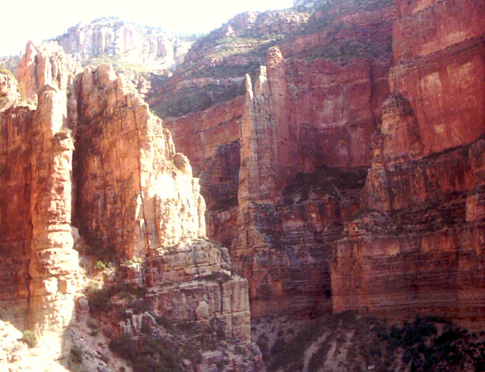
Here is one of the more amazing parts of the trail. A series of quick switchbacks takes the trail down to the area in the center of the photograph, then the trail hugs an indentation in the cliff as it descends down to the next shelf in the distance.
Here is the view looking down into the lower middle canyon. The steepness of the switchbacks are apparent.
Here is the view looking across the lower middle canyon up towards the North Rim.
The view looking directly across the lower middle canyon.
Same view across, but looking down.
Looking way down . . . (I'll see if I can stitch these into a vertical panorama).
Here is a picture of my mom standing on the shelf.
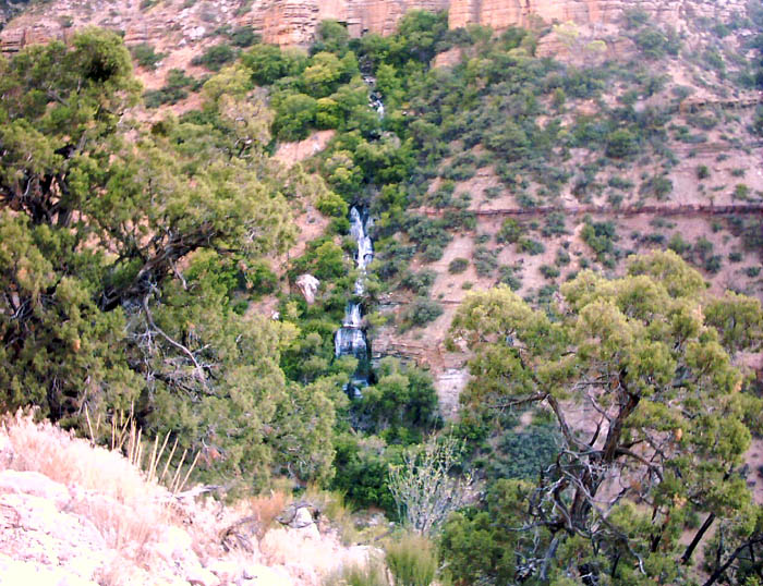
My mom taking in the view. If you look carefully in the center right, you can see power lines ascending up from the canyon. These lines power power pumps at Roaring Springs. The water is pumped 3000 vertical feet up to the North Rim through a series of high pressure pipes attached to the cliffs.
Looking down on the trail . . .
This is the top of another vertical panorama.
The bottom half.
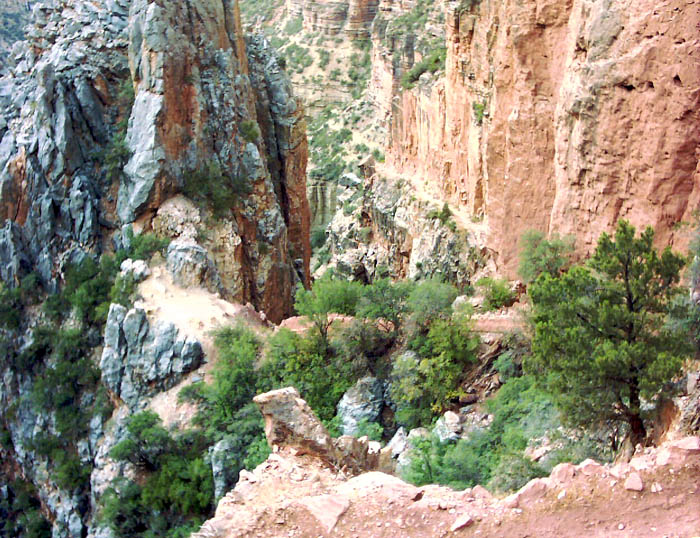
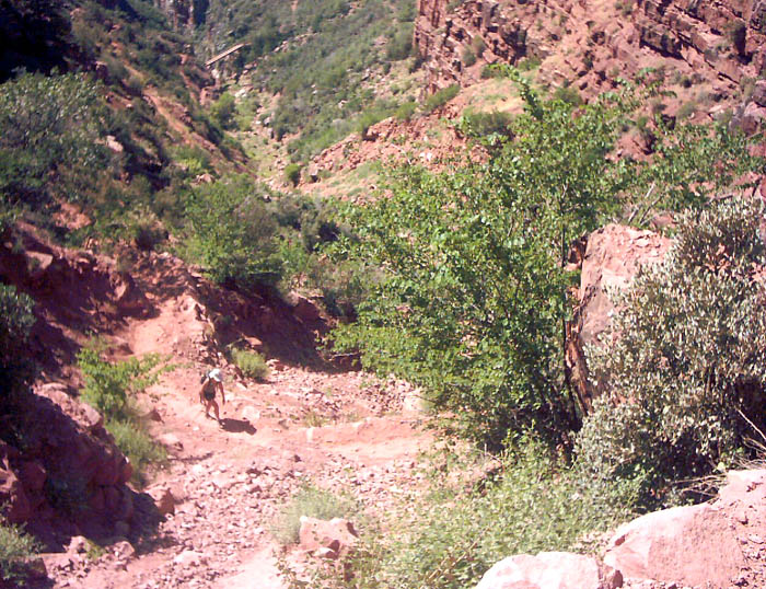
This picture was taken near the turnoff for the trail that cuts back to Roaring Springs. The vegetation tells of a more arid and hot climate. By this point, we were finally starting to get sunshine. It was 79 degrees at about 8 AM. We only wanted to imagine how much hotter it would get later in the day.
The top portion of another vertical panorama.
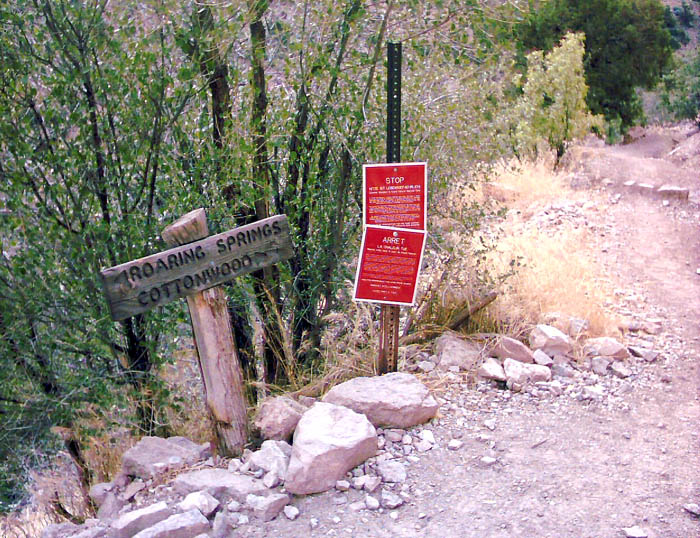
The turnoff to Roaring Springs. The Colorado River is still another 7 miles or so, and the temperature along this stretch of the trail frequently exceeds 100 deg F during the warm months. The red sign carry ominous warnings which basically say that day hikers should not attempt to go any further down into the canyon. The easy downhill hiking lures many hikers further down into the canyon than they realize. When they turn around, often during the heat of the day, they quickly find the ascent to be punishing, and the sun brutally hot. At best, even physically fit people can have a horrible and grueling climb back out in the summer months. The unfit or ill-prepared often end up with heat-related illness, needing rescue, or worse. Needless to say, we didn't go any further down the canyon. Instead we turned off towards Roaring Springs.
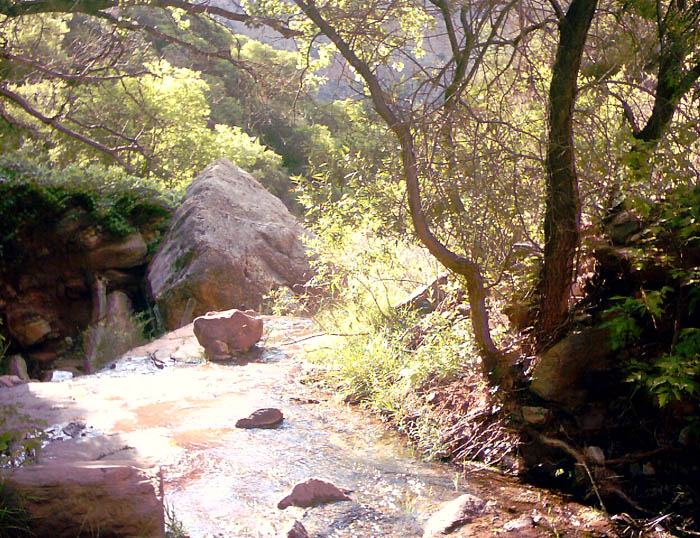
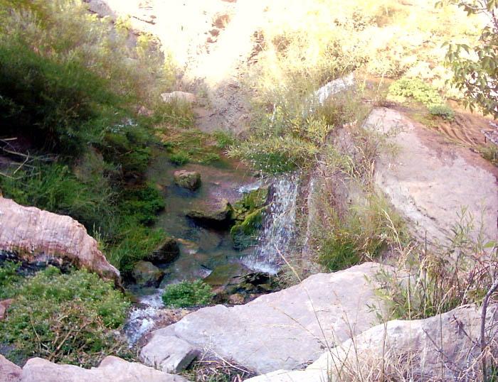
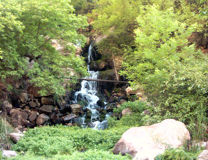
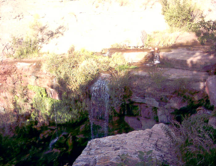
The cool and refreshing waters below Roaring Springs.
This area is a veritable oasis.
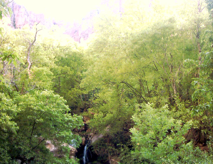
The greenery was alluring, but we didn't want to spend too much time here. The elevation of Roaring Springs is 5200 feet. We still had more than 3000 feet to climb and it was rapidly getting warmer.
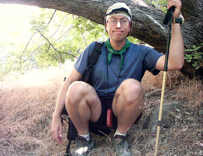
Here I am, just before leaving the oasis for the climb back up to the North Rim.
Some of the same views as before, but different lighting.
The canyon walls were quite red in the middle canyon.
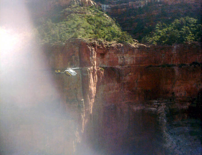
A helicopter descended down to Roaring Springs, landed, then ascended back out of the canyon. Later we learned that it was looking for some breaks in the pipes that carry the water up to the North Rim. On the way down and back up we heard a distinct hissing sound near Redwall Bridge, so we were able to tell a Ranger at Supai Tunnel of the general location of the break.
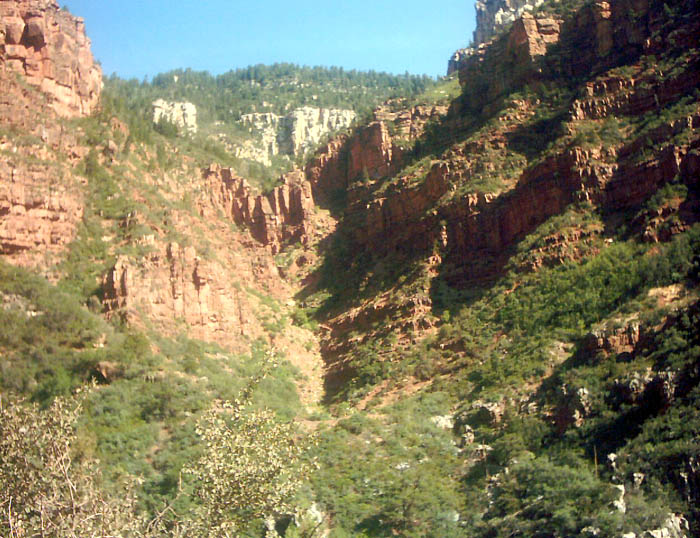
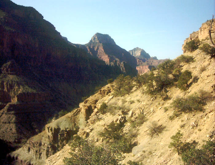
As we ascend out of the middle canyon, the white cliffs of the North Rim loom nearer.
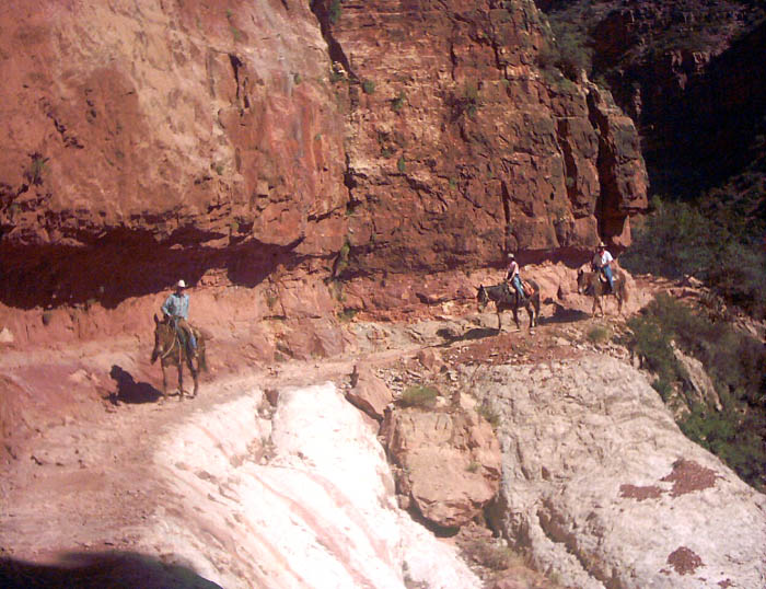
An interesting place to pass a party of horses! We found a niche to stand on the left while the horses passed.
Here is my mom ascending the switchbacks up to Supai Tunnel. It was brutally hot by then. If I recall correctly, the warmest temperatures we experienced during our hike were in the middle canyon, and were about or close to 88 deg F. Add in the sun and it easily felt like 100 deg F.
Supai Tunnel. We were able to refill our CamelBaks with fresh, cool water here. We chatted with a Ranger and told of the breaks in the water line.
We were beginning to get a whiff of success at this point -- only about 800 vertical feet to go! When we finally came out on the North Rim, it was still warm, but a pleasant breeze was refreshing.
It took us 2:10:27 to hike down from the North Rim to Roaring Springs.
I stayed at Roaring Springs for 38:46.
It took 2:00:16 to hike back up to the Redwall Bridge.
We spent another 0:30:05 hiking up to Supai Tunnel.
Then, the last 1.8 miles up to the North Rim took us 1:11:46 (including a rest break near Supai Tunnel).
Our total time was 6:31:44. We had left at 6:10 AM and finished at 12:40 pm. Depending on which mileage figures you go by, we hiked either 9.4 or 10 miles, with a total vertical drop (and gain) of 3600 feet. Some day I'd like to come back and do a run Rim-to-Rim (or maybe Rim-to-Rim-to-Rim!).
Here are the mileages and elevations for the North Kaibab Trail from the North Rim down to the Colorado River:
Trailhead 0.0 miles 8255 ft
Supai Tunnel 1.8 miles 6840 ft
Redwall Bridge 3.0 miles 6062 ft
Roaring Springs Junction 4.7 miles 5300 ft
Roaring Springs 5.0 miles 5200 ft
Cottonwood 6.9 miles 4065 ft
Phantom Ranch 13.8 miles 2546 ft
Colorado River Bridge 14.6 miles 2400 ft
North Kaibab Trail Information from the National Park Service
Planning a Grand Canyon Rim to Rim Hike This site has great information for all who dream of going Rim-to-Rim.
Home | About this Site | Disclaimer || Site Map | Subscribe to be notified when new content is posted to this site
|
Home | About this Site | Disclaimer || Site Map | Subscribe to be notified when new content is posted to this site
|