
Home | Personal | Outdoors | Travels | Blog | Work | Weather | Site Map
|
Home | Personal | Outdoors | Travels | Blog | Work | Weather | Site Map
|
|
|
Home | Personal | Outdoors | Travels | Blog | Work | Weather | Site Map
|
This page is best viewed on a high-speed internet connection. It will take approximately five minutes to load with a 56K modem.
 [275 Kb]
July 13, 2002 was a very hot afternoon in Fort Collins, so I decided to head up to the mountains. As I drove up US-34, I could see clouds building up over the mountains, a typical summertime occurrence in Colorado. I started hiking around 3:30 pm from the Bear Lake Trailhead, El. 9475 feet. Since I actually wanted to hike up Glacier Gorge, I first hiked on downhill for about half a mile to get to the Glacier Gorge Trailhead, El. 9240 feet. From there, I headed up the busy Glacier Gorge Trailhead (all distances mentioned are given from the Glacier Gorge Trailhead).

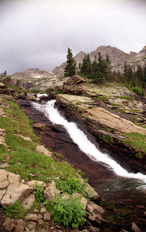
At 0.6 miles and a climb of only 160 feet, I came across this beautiful view of Alberta Falls. There were plenty of people on the trail at this point -- it was as crowded as a city sidewalk. The weather was mild, but some dark clouds were coming into view.
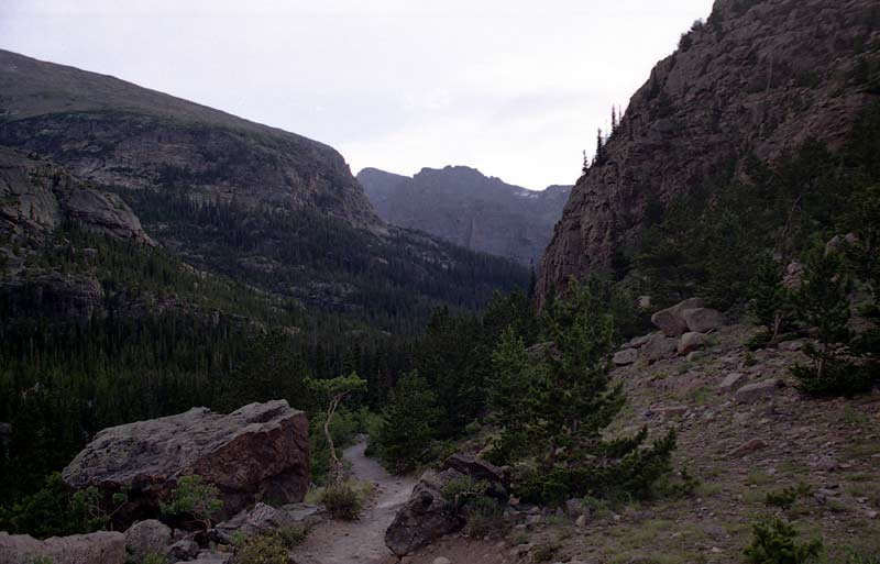
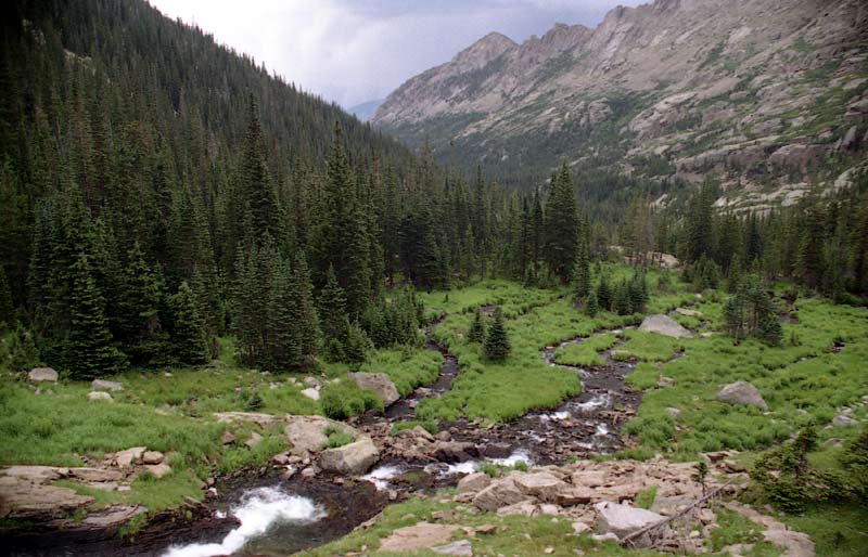
About a mile and half into the hike, you pass through a narrow canyon and enter Glacier Gorge, a long narrow U-shaped valley carved by glaciers.
As the stormed rolled over, I didn't take as many pictures and instead got out my rain gear (even though it was a hot, sunny day when I left Fort Collins, I resisted the urge to go sans rain gear -- an extra pound is always worth the safety and warmth it provides in the rain-prone high country). This picture was taken at the head of Mills Lake (2.5 miles, 700 feet of climb from trailhead), looking up the awesome Glacier Gorge. The trail skirts the east side of the lake for perhaps half a mile. Altogether, a beautiful destination in and of itself. There were not many people on the trail at this point.
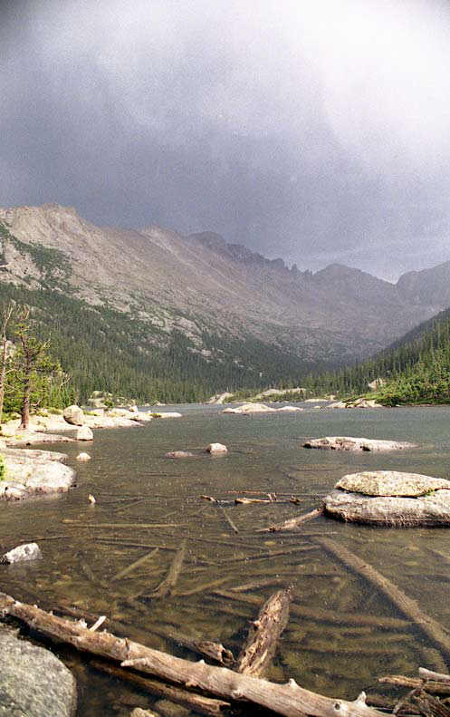
This view shows the outlet of Mills Lake with the huge hulk of Longs Peak (El. 14,255 feet) looming in the distance, with the impressive 'Keyboard of the Winds'. Longs Peak has clocked winds in excess of 200 mph, and as you can imagine, the wind must howl around those spires.
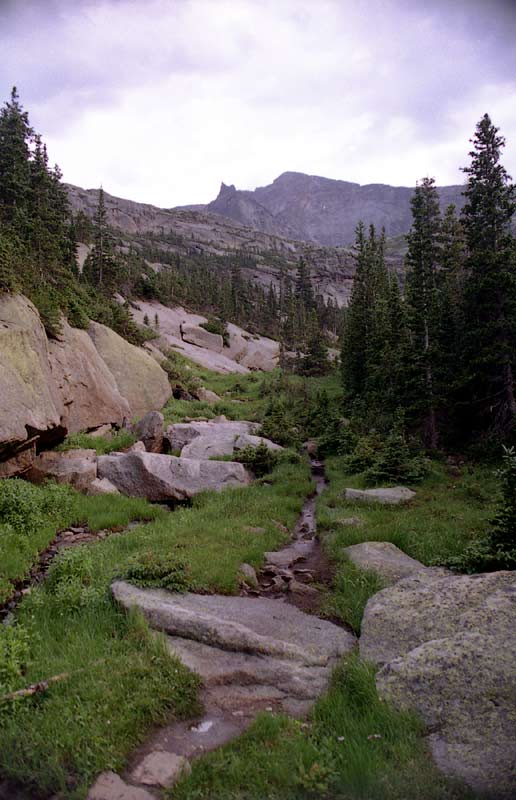
This picture was taken about 4 miles up the trail. The trail was narrower and felt much more remote. Parts of the trail crossed potential bogs on boards, a far cry from the parched ground at lower elevations. I passed a couple elk in a woody section of the trail. Further up the Gorge, the power of past glaciers was evident. In some spots, the soil was only a few inches thick and the rock was on solid rock. By this time, I was near 10,000 feet and the temperature had cooled considerably after the rain. There was not a soul in sight -- I had the entire upper Glacier Gorge to myself!
Just below the Black Lake area, the trail makes a steep next to a beautiful cascade.
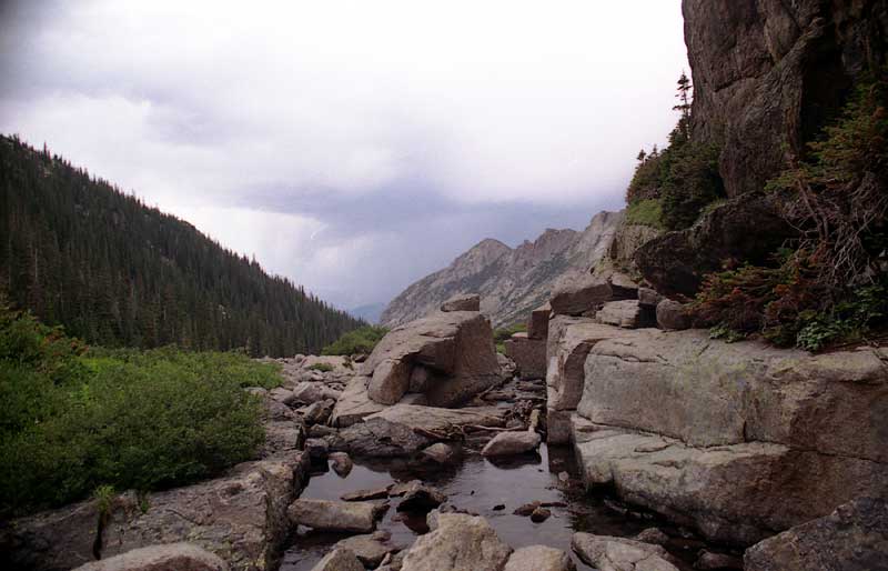
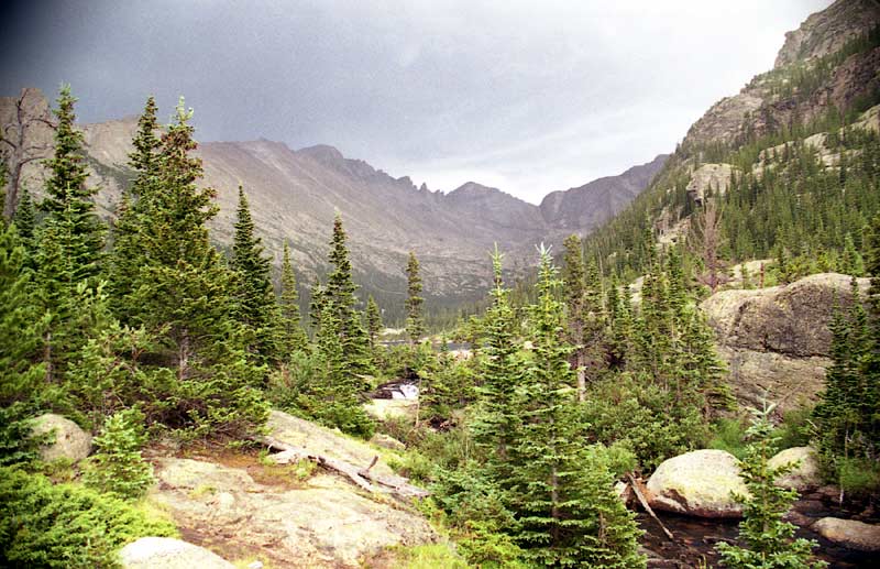
This is the view from the head of Black Lake, El. 10,669 feet. At this point, the trailhead is 1690 feet lower and 4.7 miles away. From here, the trail crosses the stream on some rocks, then skirts on the east side of the lake and up towards Longs Peak.
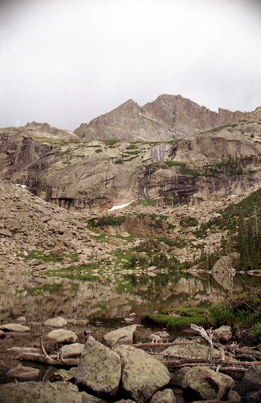
The waters were very still, providing an alluring reflection of the stunning terrain around. The head of Glacier Gorge is flanked by a great wall of formidable cliffs and spires stretching from the 4000 foot higher Longs Peak to Pagoda Mountain (13,497 ft), Chiefs Head Peak (13,579 ft), and McHenrys Peak (13,327 ft). The huge cirque is an unmistakable sign of glaciation.
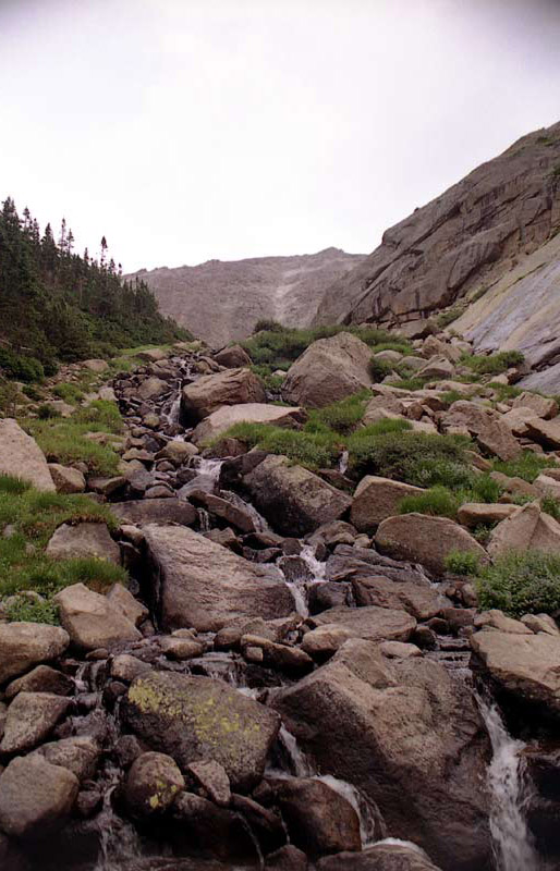
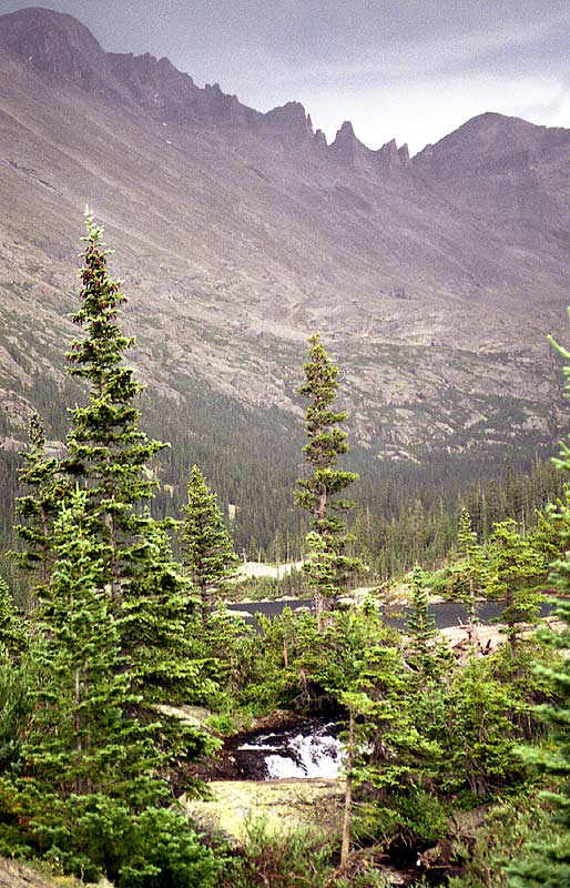
The last part of the trail was quite steep and ascended by some beautiful cascades. This is my turning point, and the place I ate my supper. The mosquitoes were trying to eat me for supper since I had neglected to bring insect repellent. It took me about an hour and fifty minutes to get to this point. Given the lateness of my start, I was hiking at a fast clip, and got here at about 5:30 pm. This view looks up a cascade which descends from small pond higher up. The summit of Longs Peak is only another 1.8 miles from here via the straightforward Trough (a class 3 climb), but the route will test your legs with an excruciating 3000 foot ascent in the last mile.
This picture was taken by the cascade looking down the gorge. On my way back towards Mills Lake, I spotted one hardy backpacker coming up the trail.
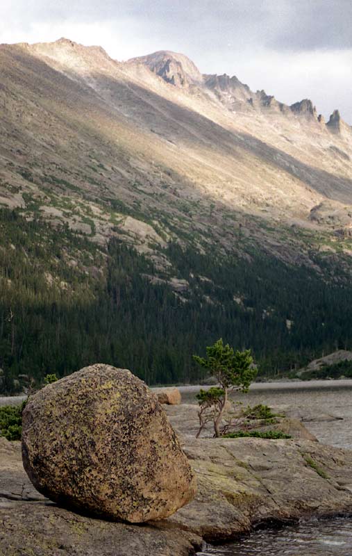
Back at Mills Lake, this rock provided a sublime contrast with the rugged background of Longs Peak.
As the trail afforded some beautiful views of Estes Park as I came out of the canyon and descended the gentle switchbacks above Alberta Falls.
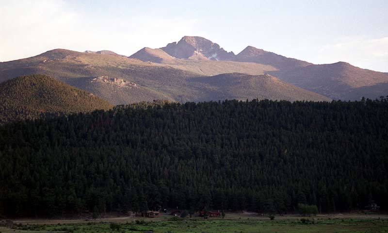
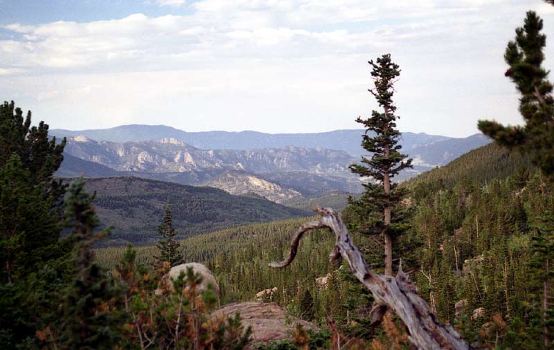
As I drove through Moraine Park, I stopped to snap a few pictures as the setting sun lit up. The Diamond face of Longs is hidden in the shadows.
Altogether, this was a lovely hike through the spectacular byproduct of a colder era. With rest stops included, the 11 miles took a little under 4 hours. I gained about 2100 feet in elevation.
Home | About this Site | Disclaimer || Site Map | Subscribe to be notified when new content is posted to this site
|
Home | About this Site | Disclaimer || Site Map | Subscribe to be notified when new content is posted to this site
|