Home | Personal | Outdoors | Travels | Blog | Work | Weather | Site Map
|
Home | Personal | Outdoors | Travels | Blog | Work | Weather | Site Map
|
|
|
Home | Personal | Outdoors | Travels | Blog | Work | Weather | Site Map
|
[INTRO PHOTO]
Fellow adventurers: Bill Dare, Eric Sigler, Dan Turk, Stephen Turk, and a local dog which followed us all the way to the top!
Photo caption.
Posted: Last modified:

Located in the ?? range ... previous climbs (and/or reports), interesting facts. Summarize the trip (backpack vs. day hike, training vs. social hike vs. serious mountaineering)
Give highlights?
This peak . . . interesting facts about the trip down and/or backpack in, camping, etc.
Details of the climb (if starting from backpacking)
Time on top, 14'er #, weather, interesting features, interesting people.
To get the full immersive experience, I've prepared a 360 degree panorama:
[Panoramic photo]
W N E S
Click on the panorama to see the full size [size Kb].
Or you can view it interactively using this panorama viewer [size Mb -- warning, this will take a while to load on a modem connection].
If you have trouble viewing this file, you can also download this executable, save it to your desktop, then double-click on it to view the panorama. The executable file contains a viewer that should work regardless of your web browser.
From left to right, the main features are:
1. blah blah valley
[ Group Photo]
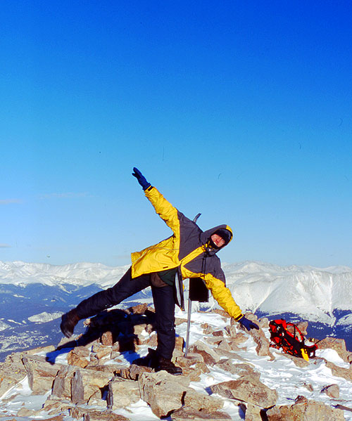
[ Crazy shot ]
[ Views of other peaks ]
I took a couple video clips which may be viewed using Windows Media Player. If using a modem, the broadband version will take very long, so a reduced-quality dial-up version is available:
Clip 1: Broadband [size Mb] or Dial-up [size Kb]
These files are in Windows Media Player format, so they should load automatically if you're on a Windows computer. There is no sound (in case you were expecting some).
Option sections - history of peak, wildlife, route info and alternates, map, gear, food
Might try to include feelings, sounds, smells - other thoughts about life and mountains, goals, etc.
Add hit counter
Estimated Pressure at summit: 590.5 mb (equivalent pressure altitude of 15,250 feet in summer)
Distance: ~8.3 miles roundtrip
Vertical climb: ~3500 feet
Conditions: Wind blown snow, crusty – needed snowshoes in few areas, less snow on ridges, exposed rocks, avalanche danger minimal
Weather: Very cold, but sunny, with high winds on exposed ridges
17ºF at start, light winds
5.7ºF on summit with 10-20 mph winds
Worst conditions: On exposed ridge just before summit, temperatures in the single digits, winds of 20-35 mph gusting to ~55 mph at times. Highest recorded gust: 42.7 mph (but only took measurements for a minute or two due to the extreme conditions).
|
||||
Home | About this Site | Disclaimer || Site Map | Subscribe to be notified when new content is posted to this site
|
Home | About this Site | Disclaimer || Site Map | Subscribe to be notified when new content is posted to this site
|