Home | Personal | Outdoors | Travels | Blog | Work | Weather | Site Map
|
Home | Personal | Outdoors | Travels | Blog | Work | Weather | Site Map
|
|
|
Home | Personal | Outdoors | Travels | Blog | Work | Weather | Site Map
|
Fellow Adventurers: Earl and Christina, Eric, Greg, John, and Dan
We drove in the night before and camped at the North Cottonwood Trailhead (El. 9,880). After I fitful night of sleep, I awoke just before 4 AM. Pretty soon, most of the group were stirring as I packed up my sleeping bag and tent. After a quick breakfast of granola (eaten out of a bag -- this saves having to wash dishes :) and a banana, and a quick drive down the road to the port-a-potty (yes, some of us drove to a bathroom, rather than stumble around in the woods looking for a spot in the dark), we hit the trail at 6 AM, just a bit after first light. Christina was worried about being left behind and got a half hour head start.
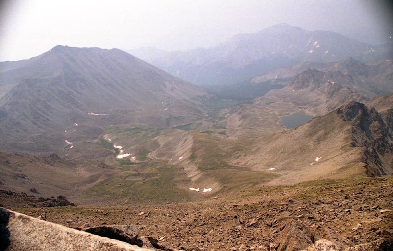
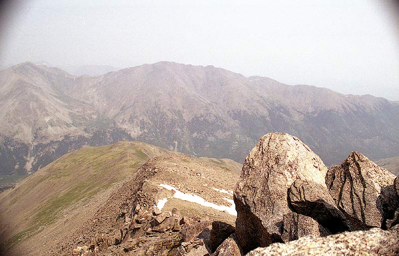
The trail was easy for the first couple miles as we traveled west up into Horn Fork Basin. The rushing water of Cottonwood Creek created a nice sounds cape for our ears since we couldn't see much for the first half hour or so. The trail started to steepen as we turned north toward our first goal, Mount Harvard. At about 7 AM, we came across this view of some peaks on the ridge south of Harvard:
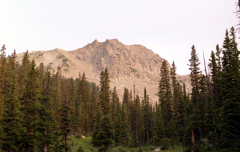
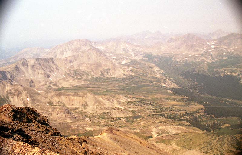
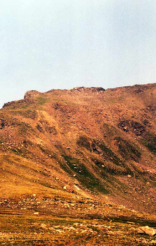
By 8 AM, we were well into Horn Creek Basin, and started to have some tremendous views after we crossed tree line at about 11,800 feet. The following picture is looking up at Harvard from the trail at about 12,000 feet. As you can see, there is still a long ways to go, since we have to ascend the bench in the foreground and then gain the summit via a steep climber's trail.
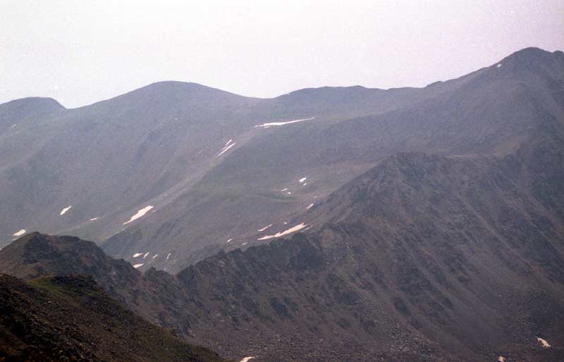
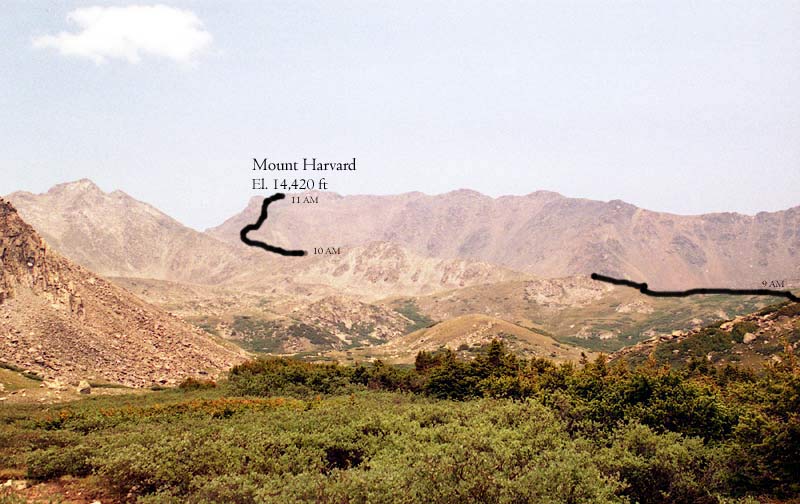
By 9:30 AM, we were well into the upper reaches of Horn Creek Basin, ascending a series of benches near Bear Lake. The following picture is taken on the trail looking up at the summit of Harvard. Only another thousand vertical to go! The trail is faintly visible in the lower part of the picture. It winds left and out of the picture.
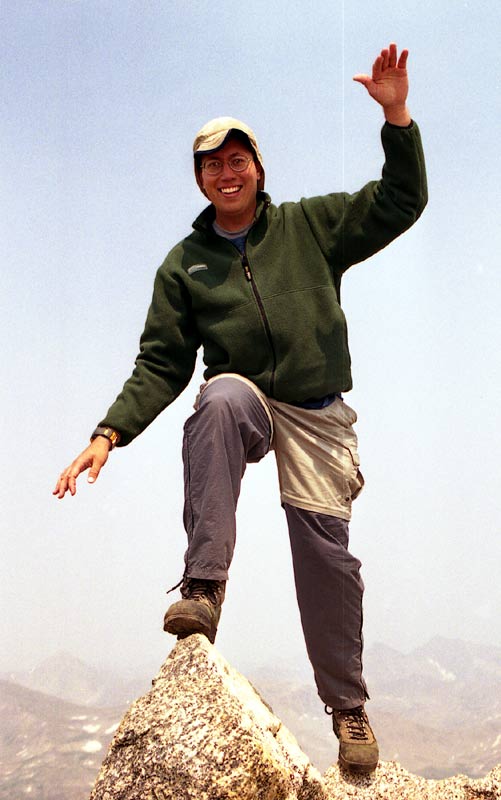
By this point, I was lagging behind (I had donated blood a few days before, and was really feeling the altitude). Most of the group were a good way higher than me, and Christina was already at the top. I forced myself to breathe more rapidly and deeply (almost like hyperventilating) for the final 400 feet, which helped me sustain a faster pace (otherwise I had to stop and rest for a few minutes climbing about 30 feet). The final 1000 vertical feet are almost always the hardest part of climbing a 14'ner, partly because the of the altitude, and partly because this is usually the steepest part of the trail. But as you can see, conquering the summit was well worth the effort.
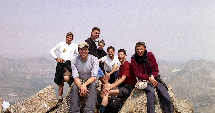
Here's a picture of our group at the summit. From left to right: Earl Ellingson, Jonathan Vigh (me), Eric Sigler, Christina Ellingson, Greg, Dan Turk, and John.
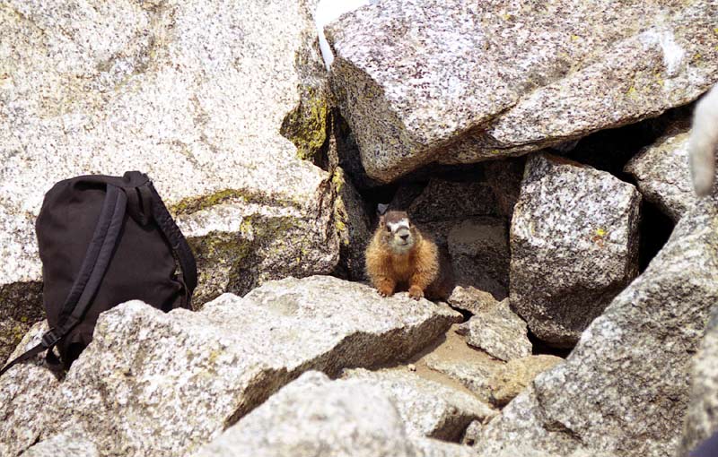
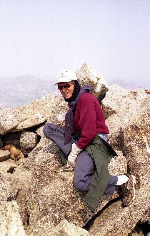
We had some company on the summit!
The views were tremendous, despite the smoky haze caused by the numerous fires burning across the West. The temperature at the top was about 60 degrees with light winds. It was about the warmest temperature I've ever experienced at the top of a 14'ner. This is John taking a leisurely rest by the summit rock.
The following galleries show several series:
|
|
|
|
|
|
|
|
|
|
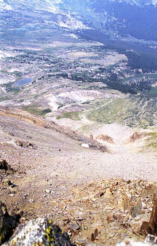
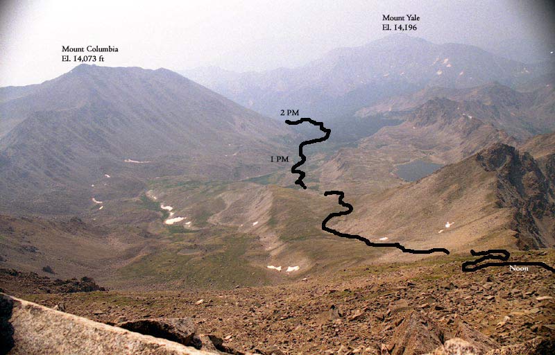
After about 40 minutes of reveling in the thin, but warm air at the summit, I headed back down the way I came up, while Dan, Earl, Christina, and Greg headed along the ridge that connects Harvard and Columbia. I hiked back in solitude, snapping some more pictures along the way. The following picture summarizes my descent:
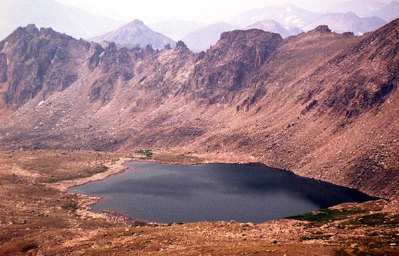
I passed this view of Bear Lake at about 12:30 PM. The elevation was approximately 13,000 feet:
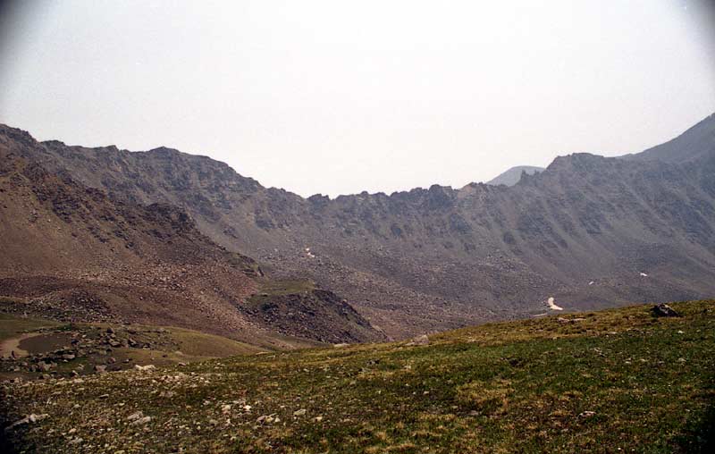
As I was descending, I could look over and see the nasty traverse from the upper bench. Needless to say, I was happy to be on the easy trail. Most of the group had to descend to 12,800 feet on the other side of the ridgeline to avoid several hairy spots. Eric stayed mostly on top of the ridge.
It was quite hot going down, especially for the last few miles. I finished the hike at about 2:20 PM with a giant heel blister and many achy sore muscles. I waited for the Columbia group for nearly four hours along with Carol (base camp manager) and Mark (who had turned around at about 12,000 feet because of altitude problems). It wasn't hard to wait, however, because I was relishing the opportunity to rest up, eat, and contemplate the day's journey. All the while, the other group were still on their grueling quest for Columbia. Everyone finally made it back by about 6 PM and we made the uneventful trip home, with a stop at Subway in Buena Vista.
Home | About this Site | Disclaimer || Site Map | Subscribe to be notified when new content is posted to this site
|
Home | About this Site | Disclaimer || Site Map | Subscribe to be notified when new content is posted to this site
|