
Home | Personal | Outdoors | Travels | Blog | Work | Weather | Site Map
|
Home | Personal | Outdoors | Travels | Blog | Work | Weather | Site Map
|
|
|
Home | Personal | Outdoors | Travels | Blog | Work | Weather | Site Map
|
Phil, Eric, and Sara accompanied me on this fabulous hike up Chicago Creek basin. We had a fantastic time fellowship with each other and enjoying the outdoors.
Much thanks to Phil Klotzbach for the use of these pictures!
Mount Evans is the fourteenth highest 14'er in Colorado and one of the two 14'ers whose summit is accessible by passenger car. With the highest paved road in the United States, anyone with sufficient driving skills, a road-worthy car, and gumption (there aren't many guard rails) can get to the 14,000 foot level quite easily. But for a real challenge, the proper way to visit Mount Evans is by a heart-pumping, lung-testing hike. On June 22, 2003, Eric, Phil, Sara, and I set out for such an adventure.
The approach was quick and easy. We left Boulder at about 6:15 AM and arrived at Echo Lake at 7:15 after an exhilarating and surprisingly traffic-free ride up Clear Creek Canyon. At the start, the weather was clear and crisp, with a 49 deg temperature and light winds. Despite the chill, we all wore shorts, lightweight clothing, and trail running shoes -- as Eric likes to say, "Light is fast, fast is speed, and speed is safety," which basically means that on a 14'er hike, you shouldn't take more than you really need, because that slows you down, and then you need more food, water, and clothing because you're going slower and will be on the mountain longer, and then you go slower because you're carrying so much stuff, and so on . . . Anyway, we took enough clothing to keep us warm should a sudden thundershower or sleet storm overtake us, but we left the heavy parkas at home, opting instead for thin wind shells and moisture-wicking clothing.
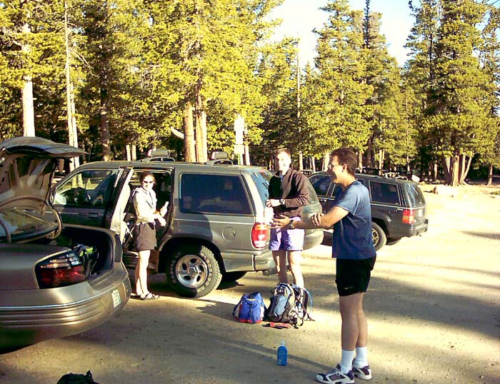
Contemplating a day of fun in the sun, we slather on the sunscreen.
From the parking lot at Echo Lake (El. 10,600 ft), we traversed the SW periphery of the lake and found the Chicago Creek Trail leading into the woods. After a slight rise, the trail headed south and descended into Chicago Creek basin. After crossing a babbling brook about half a mile down and 300 feet lower, we met up with a dirt road. Gradually climbing, we soon passed a lake that seemed to be part of a hydropower project. After about a mile on the road, we passed a couple cabins and came upon the real beginning of the wilderness. Signing into the trail register as the '???' group, we started our sojourn into the wilds of upper Chicago Creek basin. The trail climbed through some recently burned areas as well as some gorgeous meadows. The wildflowers were just starting to come out at 11,000 feet.
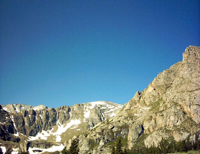
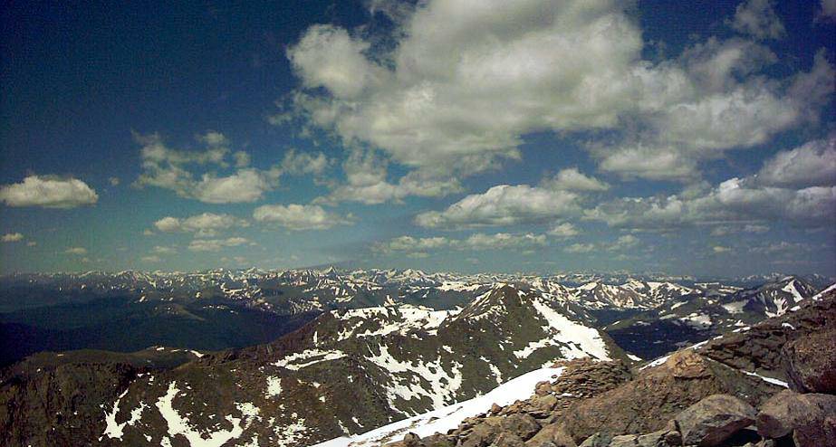
As we approach the end of the Chicago Creek basin, we started to see the spectacular headwall, along with a glimpse of the Evan's summit peeking over (far left).
This is the next to last lake. At this point, we were about four miles and an hour and fifteen minutes into our hike, so we stopped for a nutrition break.
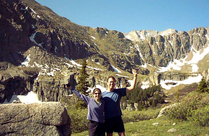
Sara and Jonathan celebrate the awesomeness of the surrounding scenery.
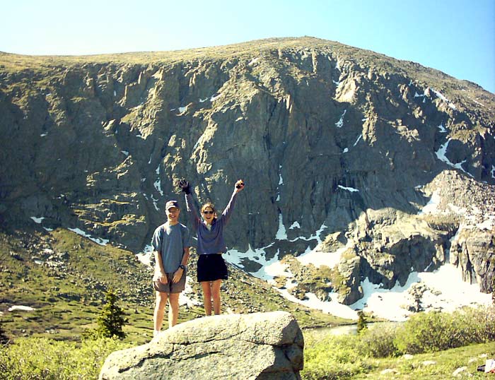
Phil and Sara framed by the imposing cliffs to the east. The Mount Evans road is somewhere on the other side.
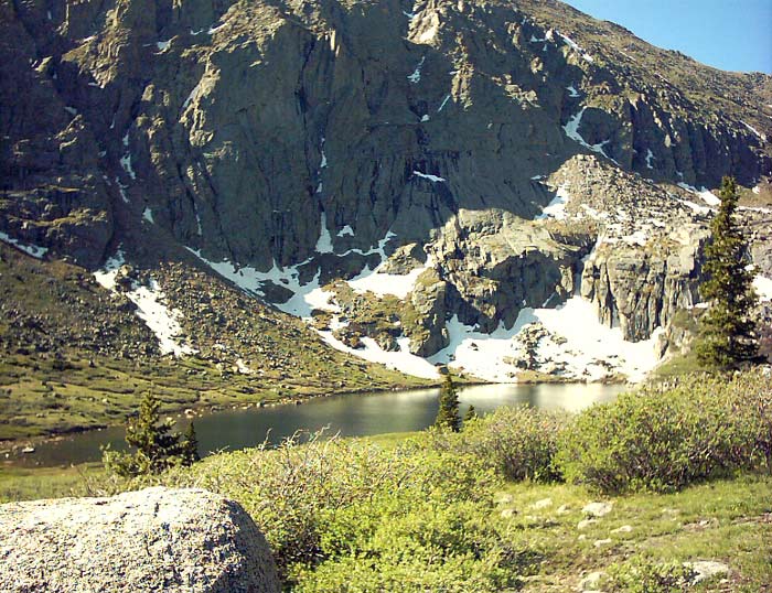
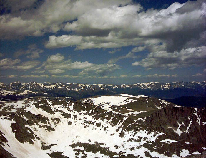
As we traveled higher, we came upon lake after lake, each more spectacular than the last. At one point, the trail snuck through some willows. Since willows are water-loving plants, there was plenty of mud to add some challenge (and potential for amusement). I tried some creative leaping techniques, but that only works to a point :) Some of us were a little more conservative and probably stayed a little cleaner. At the end of the what seemed to be the final lake, 11,400 feet or so, we climbed up past a narrow snowfield and came upon one last spectacular lake, surrounded by towering cliffs. Then we saw our challenge -- to escape the confines of the upper basin, the trail zooms up 1200 vertical feet in only 0.6 miles! Rock-hopping across the stream at the end of the lake, we started up the steep hillside. Eric, who seems to possess mountain goat genes, powered up the hillside, while I brought up the rear. After 25-30 minutes of calf-burning climbing, we reached the crest and saw the real challenge towering another 1500 vertical feet above: Mount Evans. Descending down to the parking lot by Summit Lake, we were surprised to see Dan and Greg, friends from Fort Collins and Lincoln, NE. We continued on to the summit after jogging a bit along the road.
We reached the summit about 45-50 minutes after leaving the still-frozen Summit Lake. It is a bit odd to leave a place of perfect serenity and wilderness, climbing up over the last rocks to meet --- a parking lot full of motorcycles, cars, and tourists. But in a way, it was nice to see people of all ages and abilities taking in the views and enjoying the thin air. Climbing up the last couple hundred feet, we reached Evan's summit.
It was a bit chilly (39 deg) and windy (20-30 mph), so we didn't stay on the summit for very long. But you can tell by the smiles on our faces that we were enjoying our accomplishment.
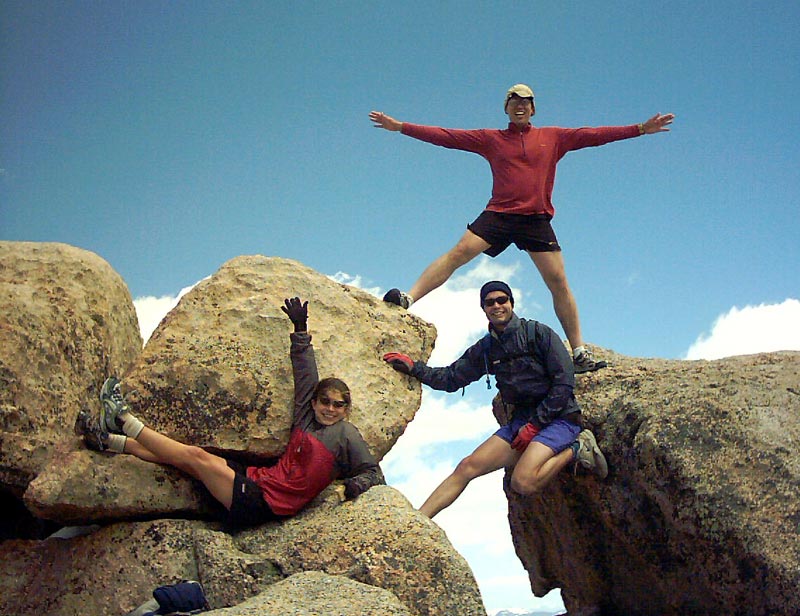
Here we are 'styling' on the summit.
Would Patagonia like to use us in an ad? We are the 'pataguchies' :)
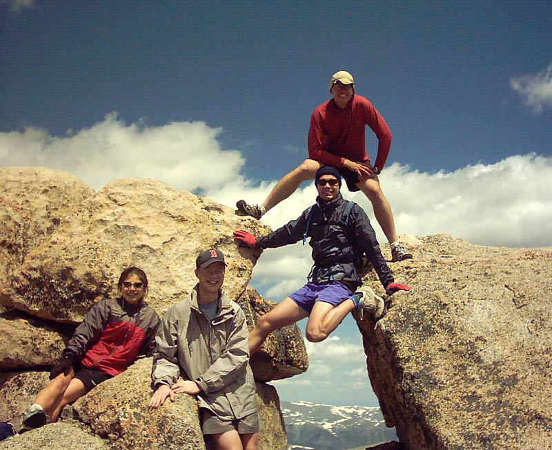
Thanks to the kindness of a stranger, here is a shot of all of us (from left to top): Sara, Phil, Eric, and Jonathan.
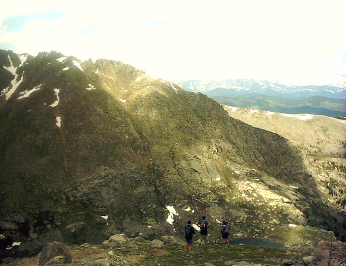
Just a hop, skip, and a jump away (well actually 1.4 miles worth of such) lies the summit of Mount Bierstadt. The formidable Sawtooth Ridge (not shown) blocks easy access.
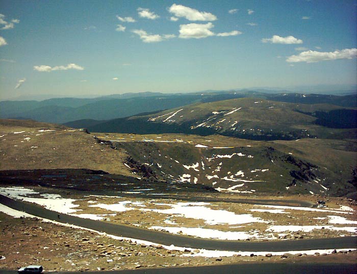
Despite being late June, snow abounds on the upper reaches of most mountains. We even saw a some skiers at Summit Lake, out for a few runs in the backcountry.
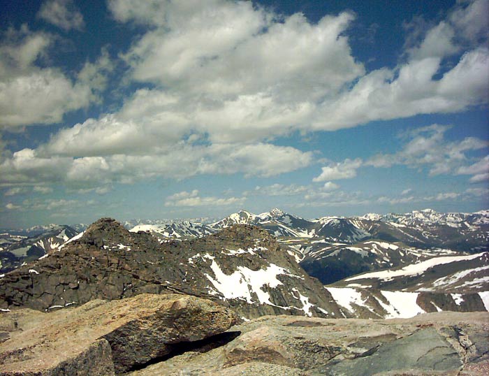
Often, other 14'ers are visible from a given peak. Grays and Torreys lie behind Evan's false summits in the center of the photograph.
After about six minutes of the summit in a 17 deg wind chill, we headed down. Already quite chilled, we stopped to warm up in Dan's vehicle for a little while. It was so nice to have a warm refuge to just hang out in for a while and visit with them. Then we headed down. Eric and I cruised down the 1200 vertical feet to the road in 12 minutes of exciting descent. Let's just say we were honing our foot-eye coordination skills. Sara and Phil were close behind. After passing Summit Lake, we climbed a couple hundred feet to the lip of Chicago Basin.
This is the lip of Chicago Basin. Where is the trail? Well, basically you just walk over the edge and look for the easiest way down. The scenery in this stretch was simply spectacular, and reminded us of 'The Princess Bride', in which Princess Buttercup throws herself down a steep Scottish hillside after the charming Wesley who she has just pushed over the edge: 'As you wish . . .' This hill was a bit too rocky to try an imitation :)
After getting through the more challenging stretches, we did a little trail running and had an enjoyable hike back to the car. Oh, yes -- I must not forget to mention that we had to hike back UP to the car. The last half mile was a nice little test to see if we had any energy left.
We hiked a total of 14.0 miles and climbed 4,600 vertical feet, taking the Chicago Creek route. The weather was great, the scenery was amazing, and the fellowship and conversation were most enjoyable. Our time to the top was 3 hours and 40 min, and our time down was about 3 hrs.
Home | About this Site | Disclaimer || Site Map | Subscribe to be notified when new content is posted to this site
|
Home | About this Site | Disclaimer || Site Map | Subscribe to be notified when new content is posted to this site
|